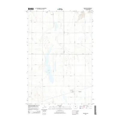
2014 Map of Englevale
USGS Topo · Published 2014About this map
Englevale anchors the southeast corner of this landscape, situated at the junction of CR-3705 and the railroad. The terrain is defined by the significant North Dakota prairie wetlands, most notably Englevale Slough and Lone Tree Lake. These water bodies dominate the central axis of the sheet, reflecting the glaciated topography of Ransom County. To the north, Stiklestad Cem provides a vital point of reference for local family history and genealogical research. The map documents a sparse but organized grid of section roads including 67th St SE and 118th Ave SE, which facilitate travel between the scattered farmsteads and the primary thoroughfare of ND-27. This survey illustrates the relationship between a small rural settlement and the surrounding marshlands and agricultural allotments in the early twenty-first century.
Find a feature on this map
25 named features on this map. Tap any name to fly to it.
Don’t see what you’re looking for? This feature index may not catch every label — zoom into the map to look around manually.
Map Details
Editions of this 2014 Englevale Map
This is the sole edition of this map. No revisions or reprints were ever made.
Other maps of this area

1895 · Lamoure
USGS Topo · 1:125,000

1897 · Tower
USGS Topo · 1:125,000

1897 · Eckelson
USGS Topo · 1:125,000

1918 · La Moure
USGS Topo · 1:125,000

1953 · Jamestown
USGS Topo · 1:250,000

1953 · Fargo
USGS Topo · 1:250,000

1956 · Fargo
USGS Topo · 1:250,000

1956 · Jamestown
USGS Topo · 1:250,000

1957 · Elliott SW
USGS Topo · 1:24,000

1957 · Elliott SE
USGS Topo · 1:24,000