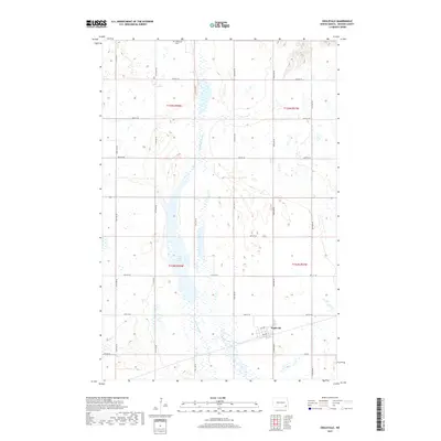
2017 Map of Englevale
USGS Topo · Published 2017About this map
Englevale serves as the primary hub in this corner of Ransom County, where a grid of rural roads connects the surrounding prairie landscape. The area is defined by significant water features, most notably the elongated waters of Lone Tree Lake and the marshy expanses of the Englevale Slough. These natural features disrupt the rigid section lines of the township and range system, creating a varied environment for local agriculture and water management. To the north, the Stiklestad Cem provides a genealogical touchstone for the local community. The map details the precise alignment of local thoroughfares like 120th Ave SE and 71st St SE, illustrating the persistent 19th-century land survey patterns that continue to organize North Dakota's rural life.
Find a feature on this map
23 named features on this map. Tap any name to fly to it.
Don’t see what you’re looking for? This feature index may not catch every label — zoom into the map to look around manually.
Map Details
Editions of this 2017 Englevale Map
This is the sole edition of this map. No revisions or reprints were ever made.
Other maps of this area

1895 · Lamoure
USGS Topo · 1:125,000

1897 · Tower
USGS Topo · 1:125,000

1897 · Eckelson
USGS Topo · 1:125,000

1918 · La Moure
USGS Topo · 1:125,000

1953 · Jamestown
USGS Topo · 1:250,000

1953 · Fargo
USGS Topo · 1:250,000

1956 · Fargo
USGS Topo · 1:250,000

1956 · Jamestown
USGS Topo · 1:250,000

1957 · Elliott SW
USGS Topo · 1:24,000

1957 · Elliott SE
USGS Topo · 1:24,000