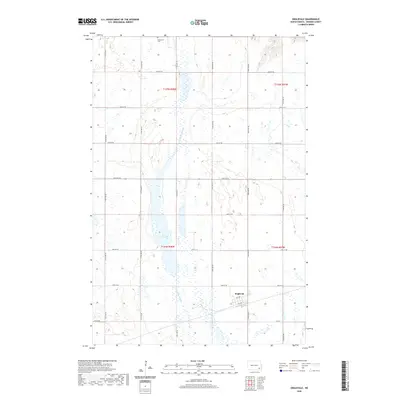
2020 Map of Englevale
USGS Topo · Published 2020About this map
Englevale sits at the intersection of a grid-iron road network and the seasonal wetlands of the prairie pothole region. This portion of Ransom County is defined by the extensive Englevale Slough, which stretches vertically across several sections, and the isolated Lone Tree Lake. These water bodies suggest a landscape that shifts with the seasons, impacting early land use and the placement of the township's surveyed roads like 118th Ave SE. To the north, the presence of Stiklestad Cem provides a specific point of interest for genealogists tracing family roots in this rural township. The map clearly delineates the Public Land Survey System boundaries, including t134n r58w and t135n r58w, illustrating how the territory was organized into square-mile sections for settlement.
Find a feature on this map
24 named features on this map. Tap any name to fly to it.
Don’t see what you’re looking for? This feature index may not catch every label — zoom into the map to look around manually.
Map Details
Editions of this 2020 Englevale Map
This is the sole edition of this map. No revisions or reprints were ever made.
Other maps of this area

1895 · Lamoure
USGS Topo · 1:125,000

1897 · Tower
USGS Topo · 1:125,000

1897 · Eckelson
USGS Topo · 1:125,000

1918 · La Moure
USGS Topo · 1:125,000

1953 · Jamestown
USGS Topo · 1:250,000

1953 · Fargo
USGS Topo · 1:250,000

1956 · Fargo
USGS Topo · 1:250,000

1956 · Jamestown
USGS Topo · 1:250,000

1957 · Elliott SW
USGS Topo · 1:24,000

1957 · Elliott SE
USGS Topo · 1:24,000