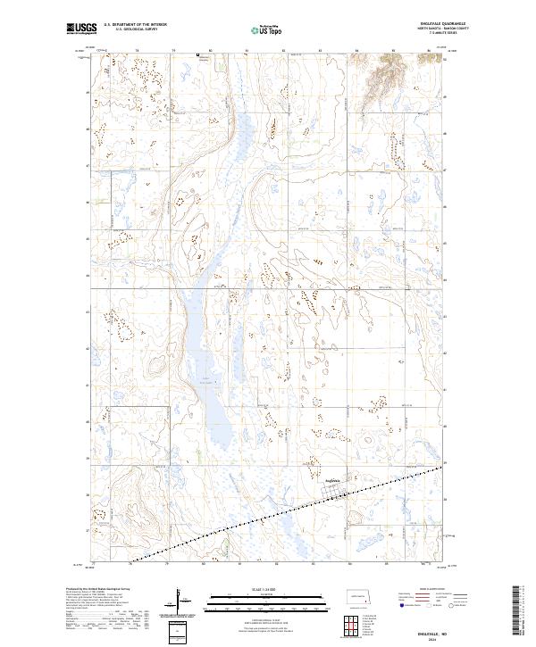
2024 Map of Englevale
USGS Topo · Published 2024About this map
Englevale stands as a quiet focus in this contemporary Ransom County landscape, characterized by the expansive wetland ecosystems of the prairie pothole region. Much of the terrain is defined by the Englevale Slough, a significant drainage and habitat feature that meanders through the central corridor of the map. Conservation efforts are highly visible through the extensive Ransom County Waterfowl Production Area and various Ransom County WPA units, which protect the local biodiversity. For those exploring local family history, the Stiklestad Cemetery sits in the northern section of the survey, offering a fixed point of genealogical interest. The water levels of Lone Tree Lake and the surrounding sloughs illustrate the hydraulic complexity of this agricultural and conservation-heavy district.
Find a feature on this map
27 named features on this map. Tap any name to fly to it.
Don’t see what you’re looking for? This feature index may not catch every label — zoom into the map to look around manually.
Map Details
Editions of this 2024 Englevale Map
This is the sole edition of this map. No revisions or reprints were ever made.
Other maps of this area

1895 · Lamoure
USGS Topo · 1:125,000

1897 · Tower
USGS Topo · 1:125,000

1897 · Eckelson
USGS Topo · 1:125,000

1918 · La Moure
USGS Topo · 1:125,000

1953 · Jamestown
USGS Topo · 1:250,000

1953 · Fargo
USGS Topo · 1:250,000

1956 · Fargo
USGS Topo · 1:250,000

1956 · Jamestown
USGS Topo · 1:250,000

1957 · Elliott SW
USGS Topo · 1:24,000

1957 · Elliott SE
USGS Topo · 1:24,000