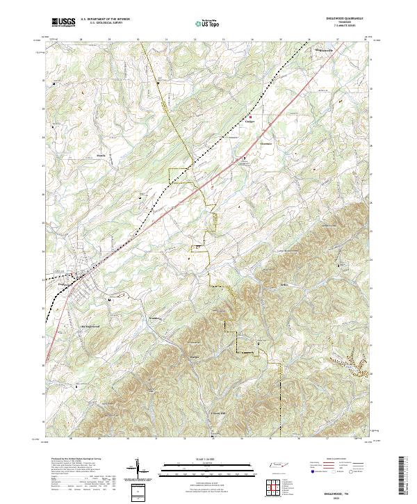
2022 Map of Englewood
USGS Topo · Published 2022About this map
The boundary between Mcminn Co and Monroe Co divides this landscape, where the town of Englewood and the original site of Old Englewood sit west of the rising knobs. This 2022 survey documents a series of small, persistent communities including Nonaburg, Gudger, Manila, and Burger, many of which are centered around early rural centers and family-named terrain. Genealogists will find a high density of burial sites across the ridges, from the Chestua Campground Community Cem to the Mount Arnon Cem and Isbell Cem. The topography is defined by prominent elevations such as McDaniel Knob and Luther Bookout Knob, with drainage moving through the valleys via Chestuee Cr and Little Chestuee Cr. Evidence of historic transit is visible in the alignment of the Old Federal Rd, while Bill Jack Gap and Martin Gap mark the natural passages through the southern hills.
Find a feature on this map
146 named features on this map. Tap any name to fly to it.
Don’t see what you’re looking for? This feature index may not catch every label — zoom into the map to look around manually.
Map Details
Editions of this 2022 Englewood Map
This is the sole edition of this map. No revisions or reprints were ever made.
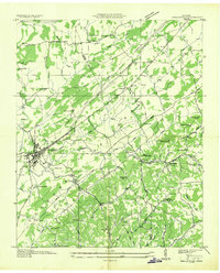
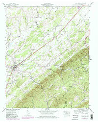
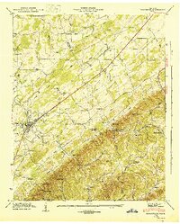
Historical Maps of Old Englewood Through Time
4 maps found