Old Maps of McMinn County, Tennessee
Explore 151 old maps of McMinn County, spanning from 1886 to today. These high-resolution historic maps reveal how streets, neighborhoods, landmarks, and natural features evolved over time — perfect for genealogy, metal detecting, research, and local history exploration.
What you can do with these maps:
- See how McMinn County changed over time: Compare historical maps to modern-day views to trace roads, homesites, rail lines & more.
- View detailed metadata: Each map includes creators, publishers, year, scale, and archive source.
- Overlay maps with satellite & LiDAR: Visualize the past alongside modern tools to explore terrain & human change.
- Trusted historical sources: Maps sourced from the USGS, Library of Congress, and other archives.
- Access maps your way: View online, download high-res files, or order prints for personal or research use.
Start exploring old maps of McMinn County to uncover forgotten places, hidden landmarks, and the deep history beneath your feet.
McMinn County, TN maps
(151)- 1886 Map of Cleveland
 1886 Cleveland1886 Print · USGSSoutheast Tennessee in the mid-1880s was a landscape defined by the iron rails and winding rivers that fueled the region's growth. You can trace early river crossings like Savannah Ford and Kincannons Ferry or locate old community centers like Chestua Mills.
 - 1887 Map of Kingston
 1887 Kingston1887 Print · USGSCentral Tennessee in the late nineteenth century was a world of river landings and new rail lines. Genealogists can trace family roots through riverside sites like Sevier's Ferry or rural hubs like Bogges X Roads and Ten Mile Stand.
 - 1891 Map of Kingston
 1891 Kingston1891 Print · USGSEastern Tennessee in the 1890s reveals a river-driven economy at the edge of the Cumberland Plateau. Genealogists can trace early crossings and landings such as Mc Elwee's Ferry and Pinhook Landing, or locate vanished crossroads like Kemmers Old Stand.2 unique versions available
 - 1892 Map of Cleveland
 1892 Cleveland1892 Print · USGSSoutheast Tennessee is captured in the late nineteenth century as a landscape of river ferries and emerging rail junctions. Genealogists and historians can locate early settlements like Charleston and Riceville or trace the original river crossings at Kincannons Ferry and Helderbrand Ford.
 - 1893 Map of Murphy
 1893 Murphy1893 Print · USGSThe Unaka Mountains and Hiwassee River valley are captured here in the late 19th century, showing a landscape of remote mountain gaps and early industry. Researchers can find old mining sites like Isabella Mine, river crossings such as Prince Fy., and rail stops at Hiwassee Sta..5 unique versions available
 - 1893 Map of Kingston, 1905 Print
 1893 Kingston1905 Print · USGSEastern Tennessee at the end of the nineteenth century is a landscape of mountain gaps and vital river landings. Researchers can trace early river crossings like Jackson Ferry, the path of the Cincinnati Southern Railroad, and settlements like Rhea Springs and Kingston.5 unique versions available
 - 1895 Map of Cleveland
 1895 Cleveland1895 Print · USGSSoutheast Tennessee thrived along the Hiwassee River and its rail corridors during the 1890s. Genealogists and historians can trace defunct river crossings like Bunker Hill Ferry and milling sites including Chestuee Mills and Longs Mills.
 - 1895 Map of Loudon
 1895 Loudon1895 Print · USGSEastern Tennessee is mapped here during a decade of rail expansion and river-based commerce. Genealogists and historians can trace family-named river crossings and early industry at Huff Ferry, Hiwassee College, and Brick Mill.6 unique versions available
 - 1901 Map of Cleveland
 1901 Cleveland1901 Print · USGSSoutheast Tennessee was a thriving hub of river and rail commerce at the dawn of the twentieth century. Genealogists can trace family homesteads near vanished landmarks like Marble Switch, Bunker Hill Ferry, or the early settlements of Riceville and Benton.4 unique versions available
 - 1914 Map of Murphy
 1914 Murphy1914 Print · USGSThe Tennessee-North Carolina borderlands come to life in this early twentieth-century survey, showcasing a landscape of mountain ridges and river-driven commerce. Researchers can trace the Louisville and Nashville Railroad to old stops like Apalachia Sta or locate the historic Prince Ferry and White Cliff Springs.3 unique versions available
 - 1934 Map of Mecca
 1934 Mecca1934 Print · USGSMonroe County was a land of steep ridges and creek-side settlements in the mid-1930s. Genealogists and local historians can trace the foundations of mountain life through landmarks like White Cliff Springs, Oldman Mill, and the Rural Vale School.
 - 1934 Map of Englewood
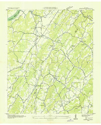
 1934 Englewood1934 Print · USGSIn the mid-1930s, the McMinn County countryside was a network of rail-side settlements and upland farms. Genealogists can trace family footprints through numerous rural landmarks like Isbell Cem, McConkey Sch, and New Bethel Ch.
 - 1935 Map of Niota
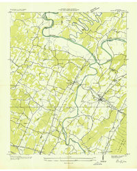
 1935 Niota1935 Print · USGSNiota and the surrounding McMinn County countryside are shown here in the mid-1930s as the rail and highway network began to modernize the region. Researchers can locate early rural landmarks like Murphys Store, the Flume Mill, and several country schools including Pine Grove Sch.
 - 1935 Map of Tellico
 1935 Tellico1935 Print · USGSMonroe County was a landscape of mountain ridges and remote outposts in the mid-1930s, anchored by the rail hub at Tellico Plains. Genealogists and researchers can trace family landmarks like Carpenter Cem, Oldman Mill, and the Rural Vale School.
 - 1935 Map of Calhoun
 1935 Calhoun1935 Print · USGSEastern Tennessee in the mid-thirties was a region of small farming settlements and growing power networks. Researchers can trace early family landmarks like Squire Liner Hollow, the community at Sanford, and historic congregations at South Liberty Ch or Britton Ch.
 - 1935 Map of Benton
 1935 Benton1935 Print · USGSThe river valleys of Polk County come alive in the mid-1930s as the Tennessee Valley Authority maps the transition from ferry crossings to modern power grids. Genealogists can trace family footprints at Chestuee Mills, Benton Station, and rural landmarks like Wiregrass Chapel.
 - 1935 Map of Athens
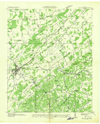
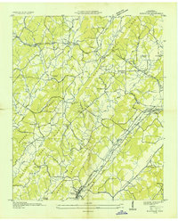
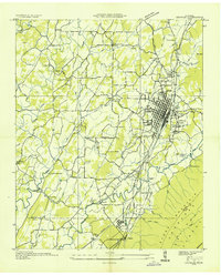
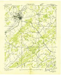
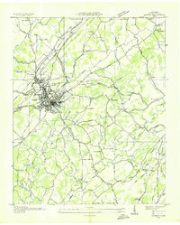 1935 Athens1935 Print · USGSMid-1930s McMinn County reveals a landscape where traditional crossroads and the emerging power grid meet. Trace family roots through local landmarks like Cedar Springs Cem, Simons Chapel, and the historic railroad junction at Athens.
 - 1935 Map of Goodfield
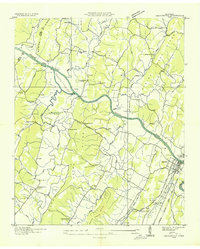
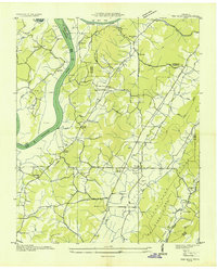
 1935 Goodfield1935 Print · USGSMeigs and McMinn Counties are captured here in the mid-1930s as the TVA began transforming the Tennessee River valley. Genealogists can locate community landmarks like Shiloh Sch, Allen Store, and Clear Springs Ch among the ridges.
 - 1935 Map of Decatur
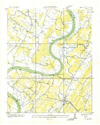 1935 Decatur1935 Print · USGSThe Tennessee River valley in Meigs County was undergoing significant change in the mid-1930s as the TVA began modernizing the region. Local researchers can trace family roots through numerous river landmarks like Vineyard Landing and rural centers such as Bogles Chapel or Decatur.
 - 1935 Map of Charleston
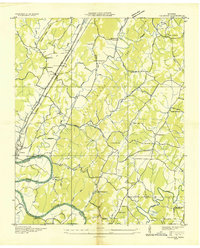
 1935 Charleston1935 Print · USGSSoutheast Tennessee is captured here in the mid-1930s as the river-and-rail economy centered on the Hiwassee flourished. Genealogists and researchers can locate family landmarks like Bethel Ch, trace the old route of the Raht Ferry, or find rural schoolhouses such as Mouse Creek Sch.
 - 1935 Map of Riceville
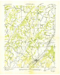
 1935 Riceville1935 Print · USGSMcMinn County was a landscape in transition in the mid-1930s, as the Southern Railway and new power lines moved through its rural valleys. Genealogists and historians can trace local landmarks like Riceville, the Barite Mine, and the CCC Camp.
 - 1935 Map of Etowah
 1935 Etowah1935 Print · USGSThe railroad town of Etowah and its Tennessee Valley surroundings are captured here in the mid-1930s as the rail and quarry industries shaped the landscape. Genealogists can trace family footprints at Gravel Hill Ch's, Longs Mill, and the rail stops at Cambria Station or Delano Sta.
 - 1936 Map of Sweetwater
 1936 Sweetwater1936 Print · USGSSweetwater and the surrounding valley are shown here in the mid-1930s as the Tennessee Valley Authority began its regional work. Researchers can locate numerous vanished rural landmarks, including Tennessee Military Institute, Christianburg, and schools like High Point Sch and Liberality Sch.
 - 1936 Map of Pattie Gap
 1936 Pattie Gap1936 Print · USGSRoane County and its neighboring valleys are captured in detail during the mid-1930s as the Tennessee Valley Authority began its regional work. Genealogists and historians can trace the foundations of rural life through family-named landmarks like Morrison Store, Gage Hill, and Cook Mill.
 - 1936 Map of Ten Mile
 1936 Ten Mile1936 Print · USGSMeigs County and the surrounding ridges come alive in this mid-1930s survey, showing the valley before the full impact of the TVA. Genealogists can trace family landmarks like Baldwin Cem, Hornsby Chapel, and the old Ten Mile Post Office.
Showing maps 1-25 of 151
Top cities of McMinn County
- Athens historical maps
- Etowah historical maps
- Englewood historical maps
- Niota historical maps
- Calhoun historical maps
Frequently asked questions
- What are the different types of historical maps available for McMinn County?
- What is the oldest map of McMinn County?
- Where can I purchase historical maps of McMinn County for my home or office?
- Where can I download high-res historical maps of McMinn County?
- Are there historical topographic maps available for McMinn County?
- Is there historical aerial imagery available for McMinn County?
- Where are historical maps of McMinn County sourced from?