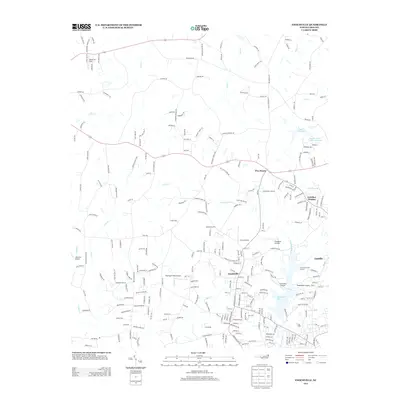
2013 Map of Enochville
USGS Topo · Published 2013About this map
Enochville and its surrounding communities sit within a landscape defined by an unusual density of private aviation and managed water resources. This 2013 survey of the North Carolina Piedmont shows a network of small landing strips, including Miller Air Park, Barringer Field Airport, and Goodnight's Airport, which speak to a local tradition of regional flight. The area's geography is further shaped by the expansion of residential developments like Corriher Heights and Five Points as they border the banks of Kannapolis Lake and the Landis Water Reservoir Lake. Numerous creek systems, such as Irish Buffalo Cr and Sills Cr, drain the terrain, supporting the transition from rural acreage to suburban infrastructure. The inclusion of the Kannapolis Golf Course near the town of Landis underscores the area's recreational development alongside its traditional aviation and water management footprints.
Find a feature on this map
256 named features on this map. Tap any name to fly to it.
Don’t see what you’re looking for? This feature index may not catch every label — zoom into the map to look around manually.
Map Details
Editions of this 2013 Enochville Map
This is the sole edition of this map. No revisions or reprints were ever made.
Other maps of this area

1893 · Statesville
USGS Topo · 1:125,000

1941 · Charlotte
USGS Topo · 1:125,000

1942 · Charlotte
USGS Topo · 1:125,000

1949 · Kannapolis
USGS Topo · 1:24,000

1950 · Concord
USGS Topo · 1:24,000

1953 · Charlotte
USGS Topo · 1:250,000

1954 · Charlotte
USGS Topo · 1:250,000

1960 · Charlotte
USGS Topo · 1:250,000

1962 · Charlotte
USGS Topo · 1:250,000

1969 · Shepherds
USGS Topo · 1:24,000