Old Maps of Kannapolis, North Carolina
Explore 46 old maps of Kannapolis, spanning from 1893 to today. These high-resolution historic maps reveal how streets, neighborhoods, landmarks, and natural features evolved over time — perfect for genealogy, metal detecting, research, and local history exploration.
What you can do with these maps:
- See how Kannapolis changed over time: Compare historical maps to modern-day views to trace roads, homesites, rail lines & more.
- View detailed metadata: Each map includes creators, publishers, year, scale, and archive source.
- Overlay maps with satellite & LiDAR: Visualize the past alongside modern tools to explore terrain & human change.
- Trusted historical sources: Maps sourced from the USGS, Library of Congress, and other archives.
- Access maps your way: View online, download high-res files, or order prints for personal or research use.
Start exploring old maps of Kannapolis to uncover forgotten places, hidden landmarks, and the deep history beneath your feet.
Kannapolis, NC maps
(46)- 1893 Map of Statesville, 1934 Print
 1893 Statesville1934 Print · USGSThe North Carolina Piedmont in the late nineteenth century was a landscape of river-powered industry and rail-connected crossroads. Researchers can trace ancestral locations through dozens of named mills like Ketchies Mill and historic crossings like Cornelius Ferry or Beattie Ford.2 unique versions available
 - 1941 Map of Charlotte
 1941 Charlotte1941 Print · USGSMecklenburg and its surrounding counties are captured here at a pivotal moment in the early 1940s. Genealogists and local historians can trace the rail-driven growth of Charlotte or locate smaller rural landmarks like Alexanders Store, Wesley Chapel, and the community at Stallings.
 - 1942 Map of Charlotte
 1942 Charlotte1942 Print · USGSCharlotte and its surrounding Piedmont communities are captured here during the early years of the Second World War. Researchers can trace the rail corridors of the Southern and Seaboard Air Line or locate family-named sites like Alexanders Store, Hoods Cross Road, and Wesley Chapel.2 unique versions available
 - 1949 Map of Kannapolis
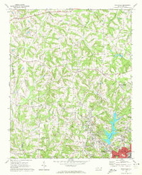
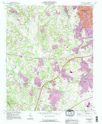
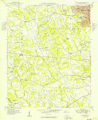 1949 Kannapolis1949 Print · USGSCabarrus and Mecklenburg counties appear here in the late 1940s as the railroad-linked industrial core of Kannapolis expands. Genealogists and historians can trace long-standing rural landmarks like Poplar Tent Ch, Odell High Sch, and Cox Mill.
 - 1950 Map of Concord
 1950 Concord1950 Print · USGSCabarrus County witnessed significant suburban development and industrial stability during the mid-twentieth century. Genealogists can trace family roots through numerous country landmarks like Heilmans Mill, Barber-Scotia College, and Carolina Memorial Park Cem.
 - 1953 Map of Charlotte, 1968 Print
 1953 Charlotte1968 Print · USGSThe North Carolina Piedmont and South Carolina borderlands are shown in detail during a period of significant growth and reservoir development. Trace the rail corridors of the Southern Railway or find family roots in towns like China Grove, Misenheimer, and Lincolnton.3 unique versions available
 - 1954 Map of Charlotte
 1954 Charlotte1954 Print · USGSThe North Carolina Piedmont in the mid-1950s shows a region of rapid growth and industrial expansion centered around Charlotte. Trace the era's infrastructure through the Southern railroad lines and locate significant landmarks like the Charlotte Naval Ammunition Depot and Lake Norman.2 unique versions available
 - 1960 Map of Charlotte
 1960 Charlotte1960 Print · USGSMid-century North Carolina and South Carolina meet in this 1960 survey of the Piedmont's industrial and textile heartland. Trace the growth of Charlotte alongside historic landmarks like Kings Mountain National Military Park and the Charlotte Naval Ammunition Depot.2 unique versions available
 - 1962 Map of Charlotte
 1962 Charlotte1962 Print · USGSThe North Carolina Piedmont in the early sixties showcases a landscape transformed by massive reservoirs and industrial growth. Researchers can trace the development of Lake Norman, locate the Charlotte Naval Ammunition Depot, or find family landmarks like Wesley Chapel and Brown & Norcott Mills.
 - 1969 Map of Kannapolis, 1972 Print
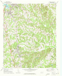
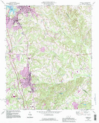
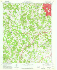 1969 Kannapolis1972 Print · USGSKannapolis and its rural North Carolina surroundings appear here in the late sixties as the area transitioned toward suburban growth. Researchers can locate early schools and cemeteries such as Shady Brook Sch, Bethpage Ch Cem, and Wallace Crossroads.2 unique versions available
 - 1969 Map of Concord, 1973 Print
 1969 Concord1973 Print · USGSConcord and Kannapolis are captured during a mid-century period of rapid suburban growth and industrial stability. Genealogists can trace family roots through neighborhood landmarks like Heilmans Mill, St James Cem, and Barber-Scotia College.2 unique versions available
 - 1970 Map of Enochville, 1972 Print
 1970 Enochville1972 Print · USGSRowan and Cabarrus counties in the early seventies reveal a landscape of rural congregations and emerging utility networks. Researchers can trace family history through numerous landmarks like St Pauls Ch, McKnight Sch, and the community at Enochville.
 - 1970 Map of China Grove, 1972 Print
 1970 China Grove1972 Print · USGSRowan and Cabarrus counties are captured here during a period of significant growth along the Southern railway corridor. Genealogists and local historians can trace the evolution of China Grove and Landis, or locate landmarks like Bostian Sch and Millers Chapel.2 unique versions available
 - 1970 Map of Cornelius, 1972 Print
 1970 Cornelius1972 Print · USGSMecklenburg County enters a new era in the early seventies as Lake Norman emerges alongside established rail towns. Local historians can trace old community hubs like Smithville and Caldwell or locate family sites at Mt Zion Ch Cem and Ramah Ch.2 unique versions available
 - 1976 Map of Cornelius, 1978 Print
 1976 Cornelius1978 Print · USGSMecklenburg County towns appear in their mid-1970s landscape before the era of rapid suburban growth. Genealogists and local historians can trace the early footprints of Davidson, Cornelius, and Huntersville alongside the banks of Lake Norman.
 - 1985 Map of Salisbury, 1986 Print
 1985 Salisbury1986 Print · USGSNorth Carolina’s industrial Piedmont region comes into focus during the mid-eighties as textile and rail towns expanded. Genealogists and historians can locate rural landmarks like Davidson College and Boones Cave State Park or trace the Southern Railway through Lexington and Salisbury.2 unique versions available
 - 1985 Map of Charlotte, 1986 Print
 1985 Charlotte1986 Print · USGSThe Piedmont region in the mid-eighties shows the rapid growth of the Charlotte metro area alongside established textile and college towns. Trace local heritage at the Reed Gold Mine or explore the rail corridors of the Southern Railway and Winston-Salem Southbound Railway.2 unique versions available
 - 1993 Map of Kannapolis, 1996 Print
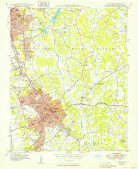
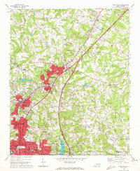
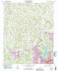
 1993 Kannapolis1996 Print · USGSThe northern Piedmont area of North Carolina is captured here in the mid-1990s as suburban growth began to bridge the gaps between historic rural communities. Researchers can locate many local landmarks including Evans College, Fisher Town, and numerous family-linked churches like Shady Grove Chapel and Poplar Tent Ch.
 - 1993 Map of Cornelius, 1996 Print
 1993 Cornelius1996 Print · USGSNorthern Mecklenburg County witnessed significant growth in the early nineties, as seen in the expanding street grids of Cornelius and Huntersville. Researchers can locate old family landmarks like Bethel Cem and the campus of Davidson College.
 - 1993 Map of Enochville, 1996 Print
 1993 Enochville1996 Print · USGSThe rural borders of Rowan and Cabarrus counties are captured here in the 1990s as longstanding communities began to expand. Genealogists can locate family landmarks such as McKnight Sch and Pleasant Grove Ch alongside Kannapolis Lake.
 - 2000 Map of Enochville, 2003 Print
 2000 Enochville2003 Print · USGSThe intersection of Rowan, Iredell, and Cabarrus counties is captured here at the turn of the millennium. Researchers can locate family landmarks such as St Enochs Ch and West Corinth Ch alongside local infrastructure like the Drag Strip and Lake Kannapolis.
 - 2010 Map of Cornelius, 2010 Print
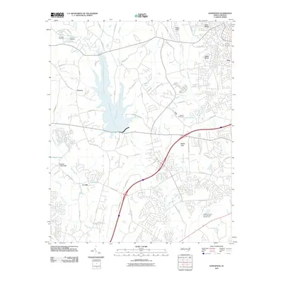
 2010 Cornelius2010 Print · USGSCovers Kannapolis, including Charlotte, Concord, and other nearby areas
 - 2010 Map of Concord, 2010 Print
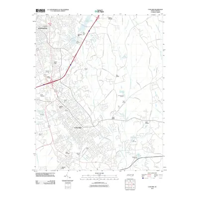 2010 Concord2010 Print · USGSCovers Kannapolis, including Concord, Jackson Park, and other nearby areas
 - 2010 Map of Enochville, 2010 Print
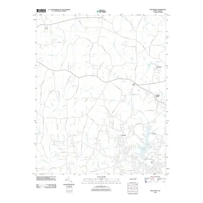 2010 Enochville2010 Print · USGSCovers Kannapolis, including Landis, Meadowcreek, and other nearby areas
 - 2010 Map of Kannapolis, 2010 Print
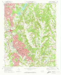
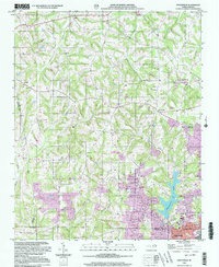
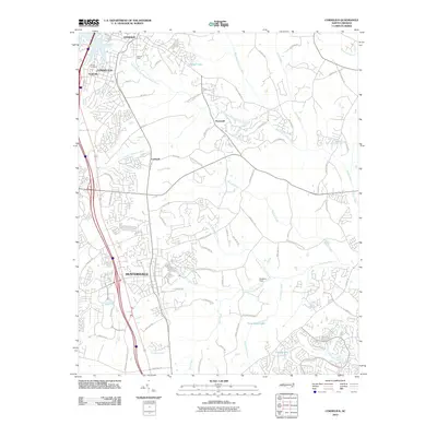
 2010 Kannapolis2010 Print · USGSCovers Kannapolis, including Charlotte, Concord, and other nearby areas
Showing maps 1-25 of 46
Top cities near Kannapolis
- Charlotte historical maps
- Concord historical maps
- Huntersville historical maps
- Mooresville historical maps
- Salisbury historical maps
- Cornelius historical maps
See more
Top neighborhoods of Kannapolis
- Heilmans Mill historical maps
- Glass historical maps
- Shady Brook historical maps
- West Brook historical maps
- Royal Oaks historical maps
- Centerview historical maps
See more
Frequently asked questions
- What are the different types of historical maps available for Kannapolis?
- What is the oldest map of Kannapolis?
- Where can I purchase historical maps of Kannapolis for my home or office?
- Where can I download high-res historical maps of Kannapolis?
- Are there historical topographic maps available for Kannapolis?
- Is there historical aerial imagery available for Kannapolis?
- Where are historical maps of Kannapolis sourced from?