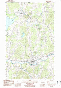
1986 Map of Enosburg Falls
USGS Topo · Published 1987About this map
The Missisquoi River anchors this mid-1980s portrait of Franklin County, winding through the valley and defining the development of Enosburg Falls. The landscape is a network of small agricultural and residential centers, including West Berkshire, Berkshire, and East Franklin, which sit just south of the International Boundary. The northeastern corner of Lake Carmi and the adjacent Lake Carmi State Park provide a clear contrast to the upland terrain marked by Little Pinnacle and numerous brooks like Giddings Brook. This survey captures the transition of the region’s traditional crossroads, showing the Enosburg Falls Corporate Boundary and the scattered hamlets of Enosburg Center and South Franklin before modern expansion, preserving the locations of rural cemeteries and local infrastructure essential for genealogical research.
Find a feature on this map
33 named features on this map. Tap any name to fly to it.
Don’t see what you’re looking for? This feature index may not catch every label — zoom into the map to look around manually.
Map Details
Editions of this 1986 Enosburg Falls Map
This is the sole edition of this map. No revisions or reprints were ever made.
Other maps of this area

1919 · Montgomery
USGS Topo · 1:62,500

1920 · Franklin Pond
USGS Topo · 1:62,500

1920 · Montgomery
USGS Topo · 1:62,500

1922 · Enosburg Falls
USGS Topo · 1:48,000

1924 · Enosburg Falls
USGS Topo · 1:62,500

1925 · Jay Peak
USGS Topo · 1:62,500

1943 · Jay Peak
USGS Topo · 1:62,500

1944 · Enosburg Falls
USGS Topo · 1:62,500

1950 · Lake Champlain
USGS Topo · 1:250,000

1953 · Jay Peak
USGS Topo · 1:62,500