
1950 Map of Lake Champlain
USGS Topo · Published 1950About this map
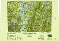
Lake Champlain serves as the central corridor for this mid-century view of the international border region, where the industrial and agricultural landscapes of New York and Vermont meet. To the west, the Adirondack Mountains rise sharply, dotted with settlements like Mineville and Witherbee, reflecting the region's mining heritage. Across the lake, the Green Mountains define the Vermont interior, punctuated by peaks such as Mt Mansfield and Camel's Hump. The map illustrates a complex network of transportation, including the Delaware and Hudson Railroad hugging the western shore and the Central Vermont Railway connecting the state capital at Montpelier with the port city of Burlington. Islands like Grand Isle and Isle La Motte are shown with their road connections established, while the vast Green Mountain National Forest covers much of the eastern terrain. This record captures the transition from rail-dependent commerce to the expanding highway system, featuring early alignments of U.S. Highway 7 and U.S. Highway 2.
Find a feature on this map
432 named features on this map. Tap any name to fly to it.
Don’t see what you’re looking for? This feature index may not catch every label — zoom into the map to look around manually.
Map Details
Editions of this 1950 Lake Champlain Map
2 editions found
Other maps of this area

1894 · Elizabethtown
USGS Topo · 1:62,500

1894 · Port Henry
USGS Topo · 1:62,500

1894 · Plattsburg
USGS Topo · 1:62,500

1894 · Ticonderoga
USGS Topo · 1:62,500

1895 · Mooers
USGS Topo · 1:62,500

1895 · Rouse Point
USGS Topo · 1:62,500

1895 · Willsboro
USGS Topo · 1:62,500

1895 · Elizabethtown
USGS Topo · 1:62,500

1895 · Mt. Marcy
USGS Topo · 1:62,500

1895 · Ausable
USGS Topo · 1:62,500