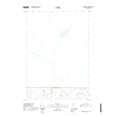
2021 Map of Enosburg Falls OE N
USGS Topo · Published 2021About this map
The Canada United States of America international border defines the northern limit of this Berkshire landscape, where the headwaters of several Vermont watercourses originate. The Pike River and its tributaries, including Sisco Brook and Alder Run, carve through the rolling elevation of northern Franklin County. This area represents a quiet, rural stretch of the Vermont borderlands where local transit is defined by a network of historic thoroughfares. Roads such as Boston Post Rd and Potato Hill Rd connect scattered homesteads and farming tracts, while the name Skunk Hollow Rd suggests the localized, descriptive naming conventions typical of the region's geography. The terrain is marked by the presence of significant local heights, notably along Ayers Hill Rd, providing a clear view of the drainage patterns and secondary roads like W Berkshire Rd that serve this northern community.
Find a feature on this map
12 named features on this map. Tap any name to fly to it.
Don’t see what you’re looking for? This feature index may not catch every label — zoom into the map to look around manually.
Map Details
Editions of this 2021 Enosburg Falls OE N Map
This is the sole edition of this map. No revisions or reprints were ever made.
Other maps of this area

1919 · Montgomery
USGS Topo · 1:62,500

1920 · Franklin Pond
USGS Topo · 1:62,500

1920 · Montgomery
USGS Topo · 1:62,500

1922 · Enosburg Falls
USGS Topo · 1:48,000

1924 · Enosburg Falls
USGS Topo · 1:62,500

1925 · Jay Peak
USGS Topo · 1:62,500

1943 · Jay Peak
USGS Topo · 1:62,500

1944 · Enosburg Falls
USGS Topo · 1:62,500

1950 · Lake Champlain
USGS Topo · 1:250,000

1953 · Jay Peak
USGS Topo · 1:62,500