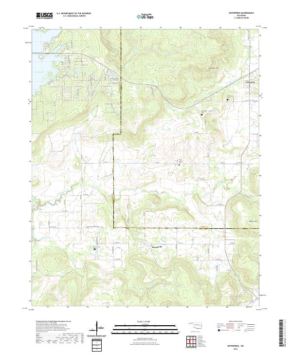
2022 Map of Enterprise
USGS Topo · Published 2022About this map
The boundary between Pittsburg County and Haskell County bisects this landscape where the undulating hills of southeastern Oklahoma meet the expansive reaches of Eufaula Lake. The map centers on a region defined by its creek systems, where Longtown Creek and Brooken Cr carve through the terrain beneath the prominent elevations of Brooken Mtn and Beaver Mtn. Rural life is anchored by small settlements like Enterprise and Russellville, where local history is preserved at the Enterprise Cem, Palestine Cem, and West Liberty Cem. The network of section roads like N4250 Rd and E1260 Rd provides access to isolated agricultural features, including the Ware Farm Landing Field and the aptly named Cattle Pasture Rd. This survey documents a quiet rural corridor where the legacy of early land divisions and family farms persists alongside the modern shoreline of one of the state’s largest reservoirs.
Find a feature on this map
62 named features on this map. Tap any name to fly to it.
Don’t see what you’re looking for? This feature index may not catch every label — zoom into the map to look around manually.
Map Details
Editions of this 2022 Enterprise Map
This is the sole edition of this map. No revisions or reprints were ever made.