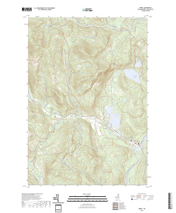
2024 Map of Errol
USGS Topo · Published 2024About this map
The confluence of the Androscoggin River and Clear Stream anchors this corner of Coos County, where the settlement of Errol serves as a gateway to the north woods. The landscape is defined by its water systems, including the Swift Diamond River which winds through the northern timberlands past Ellingwood Falls. Much of the eastern terrain is dedicated to the Umbagog National Wildlife Refuge, protecting the shoreline of Akers Pond and the surrounding wetlands. For those researching local history, the Saint Pius Forest Lawn Cem and the distinct area of Errol Village provide clear points of reference for early 21st-century development. Significant peaks like Signal Mtn and Rice Mtn rise above a network of logging roads and trails, such as the Old Greenough Pond Rd Trl, illustrating the region's enduring character as a center for both conservation and the working forest.
Find a feature on this map
56 named features on this map. Tap any name to fly to it.
Don’t see what you’re looking for? This feature index may not catch every label — zoom into the map to look around manually.
Map Details
Editions of this 2024 Errol Map
This is the sole edition of this map. No revisions or reprints were ever made.
Other maps of this area

1930 · Milan
USGS Topo · 1:62,500

1930 · Percy
USGS Topo · 1:62,500

1930 · Dixville
USGS Topo · 1:62,500

1930 · Errol
USGS Topo · 1:62,500

1933 · Dixville
USGS Topo · 1:62,500

1933 · Milan
USGS Topo · 1:62,500

1934 · Percy
USGS Topo · 1:62,500

1934 · Dixville
USGS Topo · 1:62,500

1934 · Errol
USGS Topo · 1:62,500

1934 · Milan
USGS Topo · 1:62,500