2022 Map of Esko
USGS Topo · Published 2022About this map
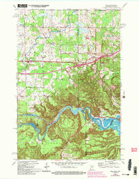
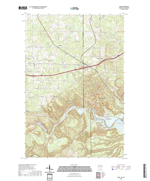
The Saint Louis River snakes through the southern reaches of this Carlton County landscape, defining the character of the riverfront communities of Fond du Lac and Thomson. This 2022 survey captures the varied geography where the Twin Ports' suburban expansion meets the wilder stretches of Jay Cooke State Park. The map documents a cluster of settlements including Esko, Harney, and Eldes Corner, each linked by a dense network of local roads like Ikola Rd and N Cloquet Rd. Significant genealogical landmarks are preserved here, such as the Augustana Cem and the Apostolic Lutheran Cem. Topographic features like Elys Peak and Oldenburg Point rise above the river valley, while smaller waterways such as the Midway River and Mission Cr drain the northern uplands. The presence of the Lennartson Airport near the northern boundary highlights the area's modern infrastructure within a traditionally rural and river-focused corridor.
Find a feature on this map
139 named features on this map. Tap any name to fly to it.
Don’t see what you’re looking for? This feature index may not catch every label — zoom into the map to look around manually.
Map Details
Editions of this 2022 Esko Map
This is the sole edition of this map. No revisions or reprints were ever made.