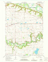
1964 Map of Essig
USGS Topo · Published 1988About this map
The Chicago and North Western railroad cuts a straight diagonal through this mid-1960s agricultural landscape, anchoring the small settlement of Essig. Situated between the meandering curves of the Minnesota River to the north and the Cottonwood River to the south, the area is defined by its rural infrastructure and early educational system. A dense network of local schoolhouses, including School No 181, School No 186, and School No 218, reveals the distributed nature of this farming community before the era of major school consolidation.
Find a feature on this map
24 named features on this map. Tap any name to fly to it.
Don’t see what you’re looking for? This feature index may not catch every label — zoom into the map to look around manually.
Map Details
Editions of this 1964 Essig Map
2 editions found
Other maps of this area

1953 · New Ulm
USGS Topo · 1:250,000

1957 · New Ulm
USGS Topo · 1:250,000

1958 · New Ulm
USGS Topo · 1:250,000

1964 · New Ulm
USGS Topo · 1:24,000

1964 · Sleepy Eye NW
USGS Topo · 1:24,000

1964 · Sleepy Eye
USGS Topo · 1:24,000

1964 · Essig
USGS Topo · 1:24,000

1964 · Lafayette
USGS Topo · 1:24,000

1964 · St George
USGS Topo · 1:24,000

1965 · Hanska
USGS Topo · 1:24,000