
1964 Map of Essig
USGS Topo · Published 1965About this map
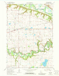
The Chicago And North Western railroad cuts a straight path through the agricultural heart of Milford and Sigel townships in the mid-1960s. The small settlement of Essig serves as a central hub for the surrounding farmsteads, which are punctuated by numerous rural schoolhouses such as School No 213 and School No 186. The landscape is defined by the winding course of the Minnesota River in the north and the Cottonwood River in the south, both of which have carved distinct bluffs and valleys through the prairie.
Find a feature on this map
23 named features on this map. Tap any name to fly to it.
Don’t see what you’re looking for? This feature index may not catch every label — zoom into the map to look around manually.
Map Details
Editions of this 1964 Essig Map
2 editions found
Other maps of this area

1953 · New Ulm
USGS Topo · 1:250,000

1957 · New Ulm
USGS Topo · 1:250,000

1958 · New Ulm
USGS Topo · 1:250,000

1964 · New Ulm
USGS Topo · 1:24,000

1964 · Sleepy Eye NW
USGS Topo · 1:24,000

1964 · Sleepy Eye
USGS Topo · 1:24,000

1964 · Lafayette
USGS Topo · 1:24,000

1964 · St George
USGS Topo · 1:24,000

1965 · Hanska
USGS Topo · 1:24,000

1967 · New Ulm
USGS Topo · 1:250,000