Old Maps of Brown County, Minnesota
Explore 153 old maps of Brown County, spanning from 1953 to today. These high-resolution historic maps reveal how streets, neighborhoods, landmarks, and natural features evolved over time — perfect for genealogy, metal detecting, research, and local history exploration.
What you can do with these maps:
- See how Brown County changed over time: Compare historical maps to modern-day views to trace roads, homesites, rail lines & more.
- View detailed metadata: Each map includes creators, publishers, year, scale, and archive source.
- Overlay maps with satellite & LiDAR: Visualize the past alongside modern tools to explore terrain & human change.
- Trusted historical sources: Maps sourced from the USGS, Library of Congress, and other archives.
- Access maps your way: View online, download high-res files, or order prints for personal or research use.
Start exploring old maps of Brown County to uncover forgotten places, hidden landmarks, and the deep history beneath your feet.
Brown County, MN maps
(153)- 1953 Map of Morgan, 1955 Print
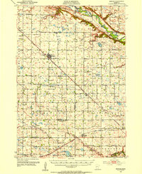 1953 Morgan1955 Print · USGSRedwood and Brown Counties are shown at their agricultural peak in the early fifties, anchored by the rail hub at Morgan. Genealogists and historians can trace dozens of rural schoolhouses and country churches like Brookville Church or Immanuel Church.
 - 1953 Map of New Ulm, 1968 Print
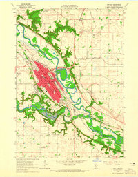
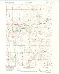
 1953 New Ulm1968 Print · USGSSouthern Minnesota in the mid-1950s is defined by its deep river valleys and the expanding reach of the Great Northern and Chicago and North Western railroads. Researchers can trace rural lineages through landmarks like the Milford State Monument, St. John's Ch, and the Upper Sioux Indian Res.3 unique versions available
 - 1957 Map of New Ulm
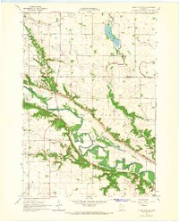
 1957 New Ulm1957 Print · USGSCentral Minnesota in the mid-fifties remains a landscape of river-valley commerce and prairie agriculture defined by its historic mission sites and rail towns. Genealogists and local historians can trace the development of New Ulm and Montevideo, or locate specific landmarks like the Milford State Monument and Minnesota Falls.
 - 1958 Map of New Ulm
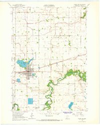
 1958 New Ulm1958 Print · USGSSouth-central Minnesota’s river valleys and prairie towns are captured here in the mid-fifties, during the height of the region's rail-and-river economy. Genealogists and historians can trace the legacy of the Upper Sioux Indian Mission or locate early rail stops along the Chicago and North Western Ry in towns like Redwood Falls and Glencoe.
 - 1964 Map of New Ulm, 1965 Print
 1964 New Ulm1965 Print · USGSThe river confluence at New Ulm was a hub of education and industry in the mid-sixties. Genealogists and researchers can trace the city's development through landmarks like Martin Luther College, the Hermann Monument, and the Lutheran Cemetery.2 unique versions available
 - 1964 Map of Sleepy Eye NW, 1965 Print
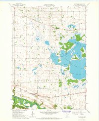
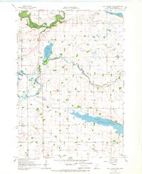
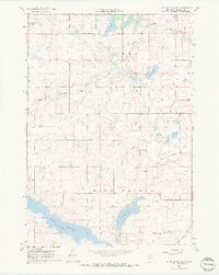
 1964 Sleepy Eye NW1965 Print · USGSThe Minnesota River valley in the 1960s reveals a landscape of historic frontier defense and quiet agricultural persistence. Researchers can trace the grounds of Fort Ridgely State Park, find the Golden Gate Cem, and locate rural landmarks like St Johns Ch.
 - 1964 Map of Sleepy Eye, 1965 Print
 1964 Sleepy Eye1965 Print · USGSSleepy Eye and the surrounding prairie townships are captured here in the mid-sixties as the region's agricultural and drainage networks were fully established. Researchers can trace family history at Home Cemetery or locate old rural schoolhouses like School No 191 and School No 193.
 - 1964 Map of Courtland, 1965 Print
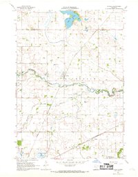
 1964 Courtland1965 Print · USGSThe village of Courtland and the intricate shoreline of Swan Lake are meticulously detailed during the mid-sixties. Researchers can locate family heritage sites like Brighton Cem, Swan Lake Ch, and the Chicago and North Western rail line.
 - 1964 Map of Essig, 1965 Print
 1964 Essig1965 Print · USGSThe rural prairie of Brown County is captured here in the mid-1960s, centered on the railroad siding of Essig. Researchers can trace old family landmarks like Marti Cem, the Milford Monument, and several numbered rural schoolhouses scattered between the river bluffs.2 unique versions available
 - 1964 Map of St George, 1965 Print
 1964 St George1965 Print · USGSThe Minnesota River valley meets the prairie wetlands of Nicollet County in the mid-1960s. Researchers can trace the path of the Old Fort Road and locate family history at West Newton Cem and Clear Lake Ch Cem.
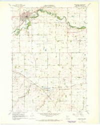
 - 1965 Map of Madelia, 1966 Print
 1965 Madelia1966 Print · USGSMadelia and the surrounding prairie were reaching a peak of agricultural development in the mid-sixties. Trace the paths of the Chicago and North Western rail line and discover local landmarks like Linden Church, Fedje Lake, and the Riverside Dam along the Watonwan River.
 - 1965 Map of Hanska, 1966 Print
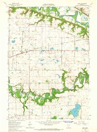
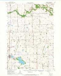 1965 Hanska1966 Print · USGSAgricultural Brown County is captured here in the mid-1960s, showing a landscape defined by industrial drainage and rail transport. Researchers can trace rural life through landmarks like Nora Ch, Mt Pisgah Cem, and the Dane Lakebed.
 - 1965 Map of Perth, 1966 Print
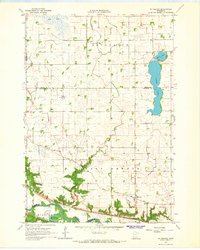
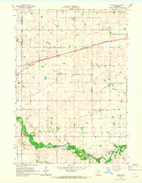 1965 Perth1966 Print · USGSThe Watonwan River valley and surrounding prairie townships are captured here in the mid-1960s. Genealogists and local historians can trace the rural landscape through the North Lincoln Cem, the town of Perth, and the Lincoln Ch along the Chicago and North Western line.
 - 1965 Map of Cambria, 1966 Print
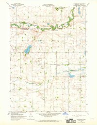
 1965 Cambria1966 Print · USGSBlue Earth and Nicollet counties are captured here in the mid-1960s, showing the agricultural prairie and the winding Minnesota River valley. Genealogists can locate family landmarks such as Our Saviors Ch, Cambria Cem, and the small settlement of Butternut.
 - 1967 Map of New Ulm
 1967 New Ulm1967 Print · USGSSouthern Minnesota in the mid-fifties is captured here as a landscape of river-valley missions and busy prairie rail towns. Researchers can trace the Yellow Medicine Trail and locate historic sites like the Morton Indian Mission and Milford State Monument.
 - 1967 Map of Clements SE, 1968 Print
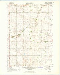
 1967 Clements SE1968 Print · USGSRedwood and Brown Counties are captured in the late sixties, showing a landscape shaped by rural townships and agricultural drainage. Genealogists can locate family landmarks like Sundown Ch, School No 1242, and the North Star Cem.
 - 1967 Map of Sanborn SE, 1968 Print
 1967 Sanborn SE1968 Print · USGSCottonwood and Brown counties in the late sixties remain a landscape of quiet township centers and winding river valleys. Genealogists can locate rural landmarks like the Delton Cem and Jeffers Ch, or trace the path of the Chicago and North Western railroad.
 - 1967 Map of Lake Hanska West, 1968 Print
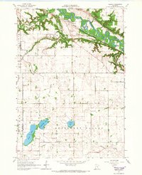
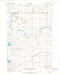
 1967 Lake Hanska West1968 Print · USGSBrown County farmland is mapped here in the late sixties as the drainage of the prairie matured. Researchers can trace rural life through numbered schoolhouses like School No 211 and old community centers such as Iberia and Quail Trap Sch.
 - 1967 Map of Springfield, 1968 Print
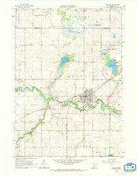
 1967 Springfield1968 Print · USGSThe Brown County prairie surroundings of Springfield were captured in the late sixties, showing the vital rail and river corridor. Researchers can find the Chicago and North Western tracks, rural burial grounds like Moravian Cem, and the industrial Kilns near the river.
 - 1967 Map of Godahl, 1968 Print
 1967 Godahl1968 Print · USGSThe prairie landscape of southern Minnesota is captured here in the late sixties, where the Brown and Watonwan County border meets. Genealogists and local historians can trace the rural communities of Godahl and Sveadahl or locate the Albion Ch and East Sveadahl Ch.
 - 1967 Map of Sanborn NE, 1968 Print
 1967 Sanborn NE1968 Print · USGSSouthwestern Brown County during the late 1960s is characterized by its prairie river valleys and railroad corridors. Genealogists and historians can trace the rural infrastructure of Charlestown and Staley, including the Sanborn rail junction, Christ Ch, and the local Townhall.
 - 1967 Map of Darfur, 1968 Print
 1967 Darfur1968 Print · USGSThe rural landscape around Darfur in the late sixties reveals a community built on the rail and river networks of Southern Minnesota. Genealogists can locate family landmarks such as Bethlehem Cem, St Johns Cem, and School No 2492.
 - 1967 Map of Lake Hanska East, 1968 Print
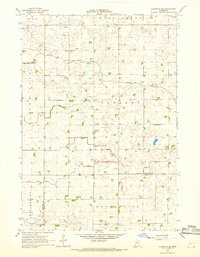
 1967 Lake Hanska East1968 Print · USGSBrown County's prairie landscape is captured here in the late sixties, showing a region defined by its lakes and agricultural drainage. Genealogists can locate family landmarks such as Lake Hanska Ch, Zion Cem, and the rural School No 226.2 unique versions available
 - 1967 Map of La Salle, 1969 Print
 1967 La Salle1969 Print · USGSWatonwan County's agricultural heartland is documented here in the late sixties as the Chicago and North Western railway connected small prairie towns. Genealogists can locate family landmarks like Rosendale Ch and Grogan or trace the winding course of the Watonwan River.2 unique versions available
 - 1967 Map of Leavenworth, 1969 Print
 1967 Leavenworth1969 Print · USGSBrown County farmland meets the winding banks of the Cottonwood River during the late sixties. Researchers can trace local roots at School No 210, identify the town site of Leavenworth, and locate family holdings near Altermatt Lake.
Showing maps 1-25 of 153
Top cities of Brown County
- New Ulm historical maps
- Sleepy Eye historical maps
- Springfield historical maps
- Hanska historical maps
- Stark historical maps
- Linden historical maps
See more
Frequently asked questions
- What are the different types of historical maps available for Brown County?
- What is the oldest map of Brown County?
- Where can I purchase historical maps of Brown County for my home or office?
- Where can I download high-res historical maps of Brown County?
- Are there historical topographic maps available for Brown County?
- Is there historical aerial imagery available for Brown County?
- Where are historical maps of Brown County sourced from?