2020s Maps of Brown County, Minnesota
Explore 24 historic maps of Brown County from the 2020s. These maps offer a rare glimpse into what life looked like during the 2020s — showing old roads, neighborhoods, homes, and landmarks that have changed or disappeared over time.
Whether you're researching your family's past, planning a metal detecting trip, or studying how Brown County's landscape evolved across the 2020s, these high-resolution maps are a powerful tool for exploring the history of this region.
- Focus on a specific era: All maps on this page are from the 2020s, giving you a focused view of this time period.
- See what’s changed: Compare century-old streets, trails, and buildings to today's modern landscape using overlays and satellite layers.
- Research with precision: Use these maps for genealogy, historical research, land use analysis, or educational projects.
- View, download, or print: Maps are fully viewable online in high resolution, and can be downloaded or printed for your own records.
Start exploring Brown County's history through authentic maps from the 2020s. This is your window into the past.
Brown County, MN maps
(24)- 2022 Map of Clements SE, 2022 Print
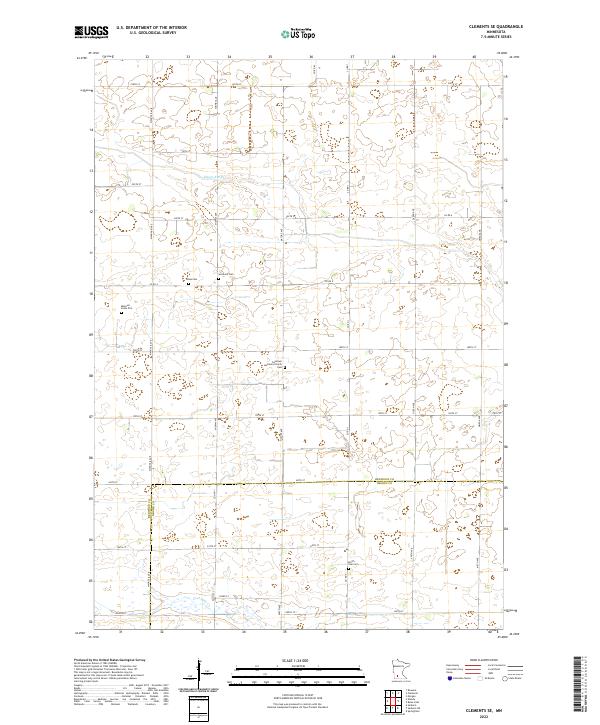 2022 Clements SE2022 Print · USGSThe rural borderlands of Redwood and Brown County are captured here in the early twenty-first century, showcasing a landscape of section-line roads and prairie wetlands. Researchers can locate quiet historic sites like North Star Cem, Sundown Cem, and the Missouri Evans Plot.
 - 2022 Map of Cambria, 2022 Print
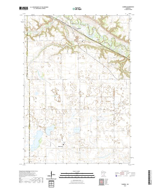 2022 Cambria2022 Print · USGSBlue Earth County's river valley and rural uplands are shown here in the modern era as they stretch between the Minnesota River and small settlements. Genealogists and local historians can trace family locations near Butternut, Cambria, and the Our Saviors Cem.
 - 2022 Map of Springfield, 2022 Print
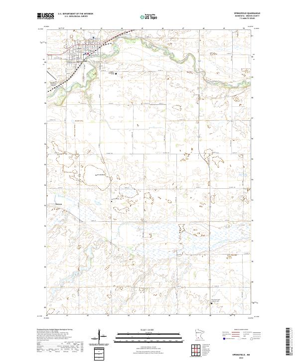 2022 Springfield2022 Print · USGSSpringfield and the surrounding Brown County prairie are shown here in the early twenty-first century as the local river system continues to shape the landscape. Genealogists can trace family sites at Moravian Cem and New Hope Faith Lutheran Cem or locate the rural settlement of Dotson.
 - 2022 Map of Hanska, 2022 Print
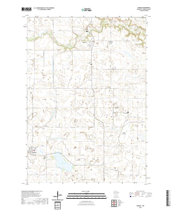 2022 Hanska2022 Print · USGSAgricultural life in Brown County is captured here in the early twenty-first century, showing a landscape defined by prairie wetlands and intensive drainage. Researchers can locate family heritage sites like Mount Pisgah Cem and Rice Lake Cem, or trace the paths of Judicial Ditch Number Ten and the Little Cottonwood River.
 - 2022 Map of La Salle, 2022 Print
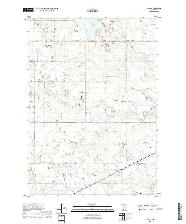 2022 La Salle2022 Print · USGSWatonwan County's rural character is on full display in this recent survey of the prairie landscape. Genealogists and historians can locate family landmarks such as the La Salle Lutheran Cem and Rosendale Cem near the banks of the Watonwan River.
 - 2022 Map of Evan, 2022 Print
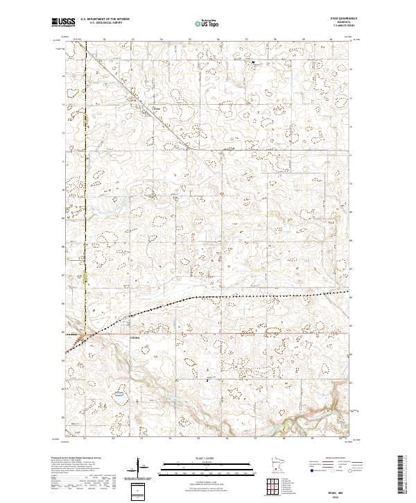 2022 Evan2022 Print · USGSSmall-town Minnesota life and agricultural development are documented here in the early twenty-first century. Genealogists can locate family landmarks like Prairieville Cem and Mielke Cem or trace the drainage paths of Sleepy Eye Cr.
 - 2022 Map of Sanborn NE, 2022 Print
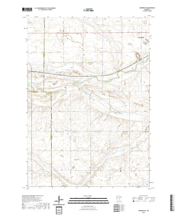 2022 Sanborn NE2022 Print · USGSAgricultural Brown County and the surrounding prairie lands come into focus in this recent topographic study. Genealogists and local historians can locate Springfield, the Christ Lutheran Cem, and the winding course of the Cottonwood River.
 - 2022 Map of Lake Hanska East, 2022 Print
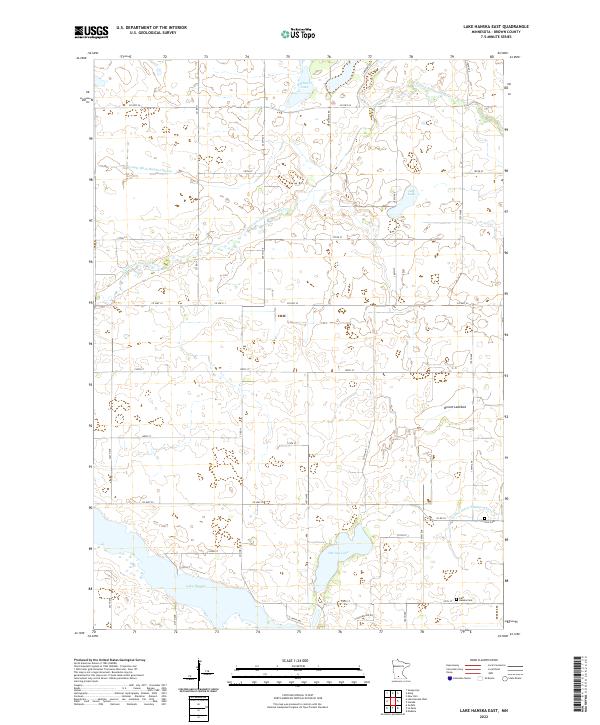 2022 Lake Hanska East2022 Print · USGSBrown County’s prairie-and-lake country is captured here during the early twenty-first century, showing a landscape shaped by water and agriculture. Genealogists and local researchers can locate family landmarks such as Zion Cem and Lake Hanska Cem near the shores of Lake Hanska.
 - 2022 Map of Madelia, 2022 Print
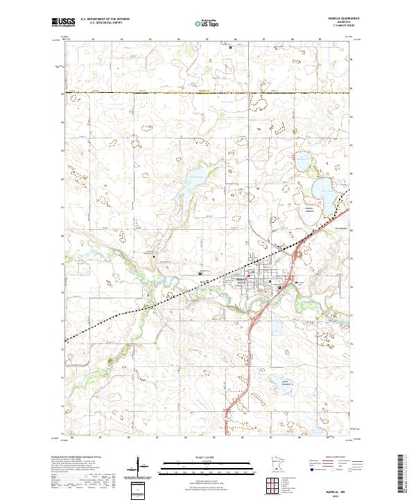 2022 Madelia2022 Print · USGSSouthern Minnesota agricultural and river life are captured here during the early twenty-first century. Researchers can locate several historical burial grounds including Riverside Cem and Linden Cem, or trace the winding Watonwan River and the dry expanse of Hopkins Lakebed.
 - 2022 Map of Saint George, 2022 Print
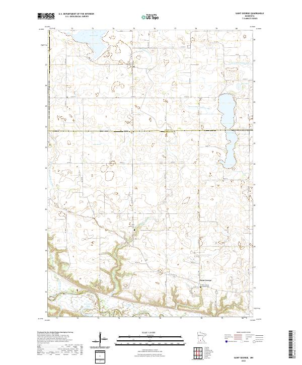 2022 Saint George2022 Print · USGSNicollet County in the twenty-first century remains a landscape of managed water and riverfront bluffs. Genealogists and historians can trace family ties at the Saint George Catholic Cem or follow the historic path of the Old Fort Rd near the Minnesota River.
 - 2022 Map of Lake Hanska West, 2022 Print
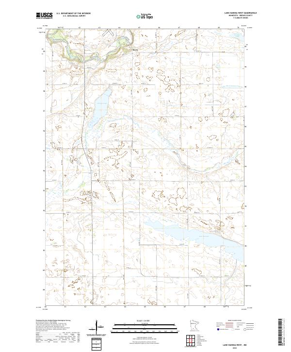 2022 Lake Hanska West2022 Print · USGSBrown County's agricultural heartland and glacial lakes are shown here as they appeared in 2022. Researchers can trace land tracts near the Cottonwood River or locate property boundaries around Iberia and the shores of Lake Hanska.
 - 2022 Map of Boise Lake, 2022 Print
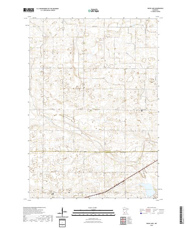 2022 Boise Lake2022 Print · USGSThe rural border of Redwood and Brown Counties comes into focus in this recent survey of the Minnesota prairie. Researchers can trace family history through several sites including Saint Raphael Cem, Dannebod Cem, and the waters of Boise Lake.
 - 2022 Map of Darfur, 2022 Print
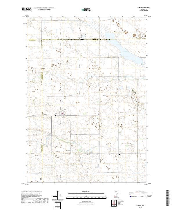 2022 Darfur2022 Print · USGSDarfur and the fertile prairies of Watonwan County are shown in this 2020s-era survey, highlighting the rural character of the Minnesota plains. Genealogists can locate several distinct burial sites including Haseman Post Cem, Salem Cem, and First Mennonite Cem.
 - 2022 Map of Courtland, 2022 Print
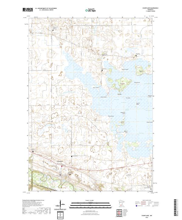 2022 Courtland2022 Print · USGSThe Minnesota River valley and the expansive waters of Swan Lake define this Nicollet County landscape. Researchers can locate numerous pioneer-era burial sites like Brighton Cem and family-named landmarks including Fechner Farm Cem and Monson Island.
 - 2022 Map of Morgan NE, 2022 Print
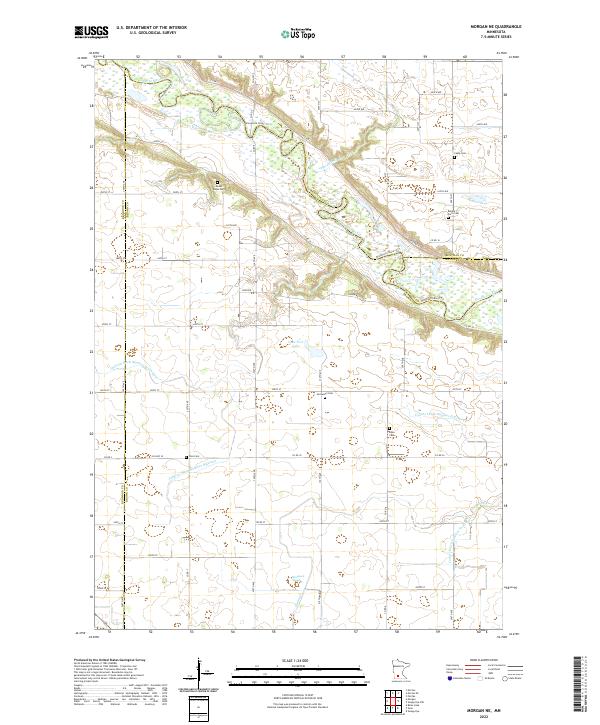 2022 Morgan NE2022 Print · USGSThe Minnesota River valley meets the prairie here in the early 2020s, showing a landscape shaped by both water and heritage. Researchers can trace ancestral roots through several rural burial grounds, including Mount Hope Cem, Boyum Farm Cem, and Zion Cem.
 - 2022 Map of Comfrey, 2022 Print
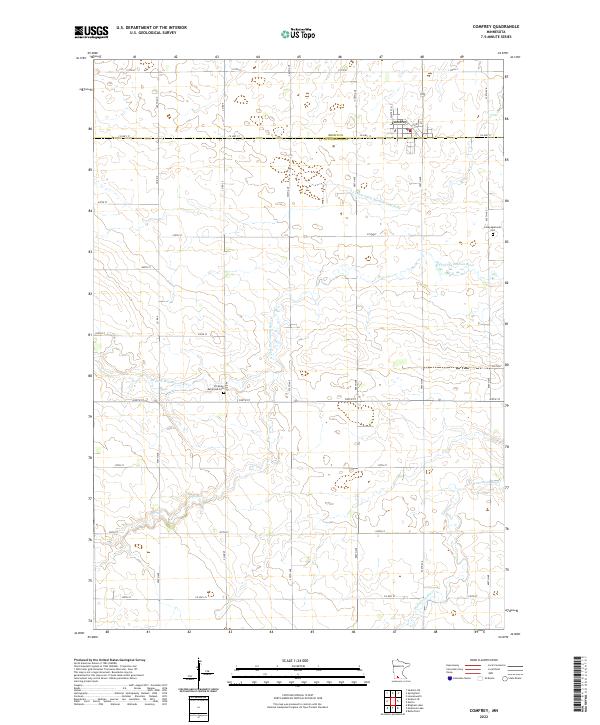 2022 Comfrey2022 Print · USGSThe area surrounding Comfrey is documented here as a settled agricultural grid along the Brown and Cottonwood county line. Researchers can locate family landmarks such as the Congregational Cem and follow the path of the N Fork Watonwan River.
 - 2022 Map of Leavenworth, 2022 Print
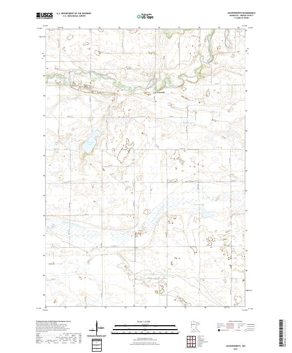 2022 Leavenworth2022 Print · USGSBrown County farmland and river valleys are documented in the early 2020s, showcasing the rural landscape south of the river. Genealogists and local historians can trace family properties near the Cottonwood River, the settlement of Leavenworth, and Altermatt Lake.
 - 2022 Map of Sleepy Eye, 2022 Print
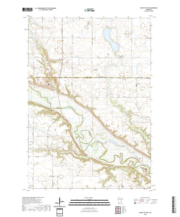
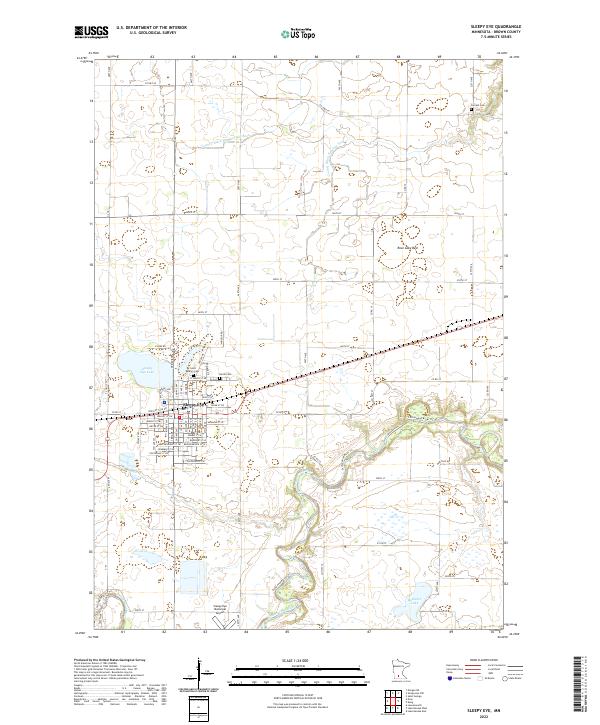 2022 Sleepy Eye2022 Print · USGSSleepy Eye and the surrounding Brown County prairies are documented here in the early twenty-first century, showing a landscape shaped by agriculture and water management. Researchers can trace family sites at Saint Mary's Cem or Home Cem and locate landmarks like Rose Lake Bed.
 - 2022 Map of Godahl, 2022 Print
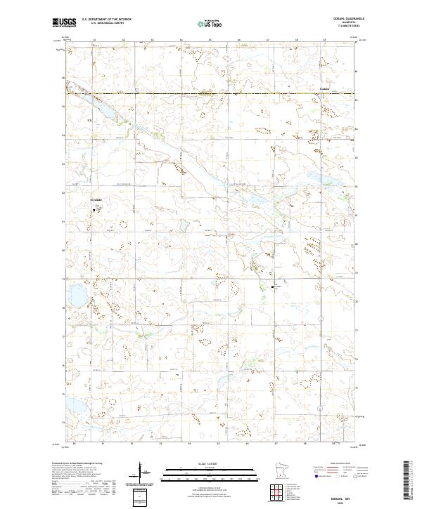 2022 Godahl2022 Print · USGSThe rural landscapes of Watonwan County are captured here in the early twenty-first century, showing the enduring agricultural character of the Minnesota prairie. Genealogists and historians can locate West Sveadahl Cem near the Sveadahl settlement and trace the paths of the Watonwan River and Butterfield Cr.
 - 2022 Map of Essig, 2022 Print
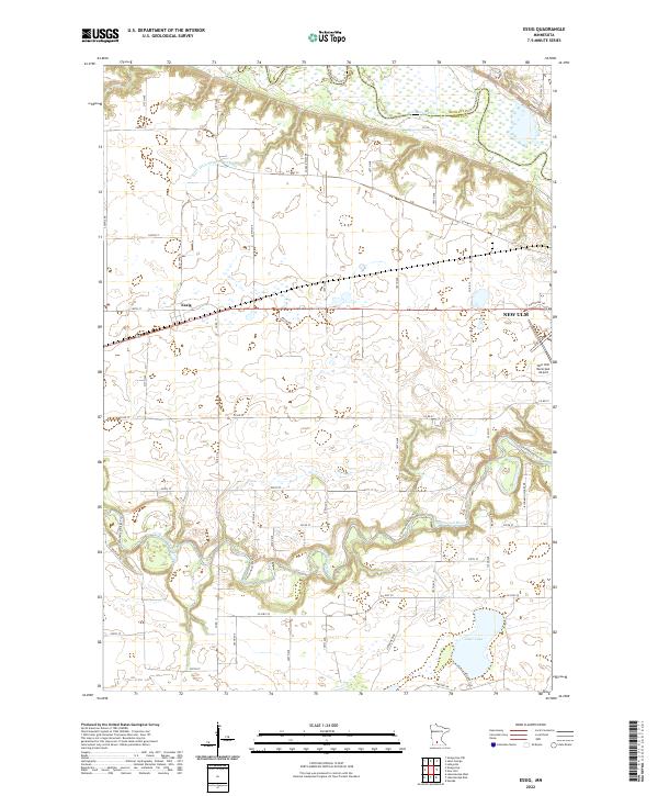 2022 Essig2022 Print · USGSBrown County farmland surrounds the small settlement of Essig in this modern survey of the Minnesota prairie. Genealogists and researchers can trace the agricultural grid and landmarks like Clear Lake, the New Ulm Municipal Airport, and the meandering Cottonwood River.
 - 2022 Map of New Ulm, 2022 Print
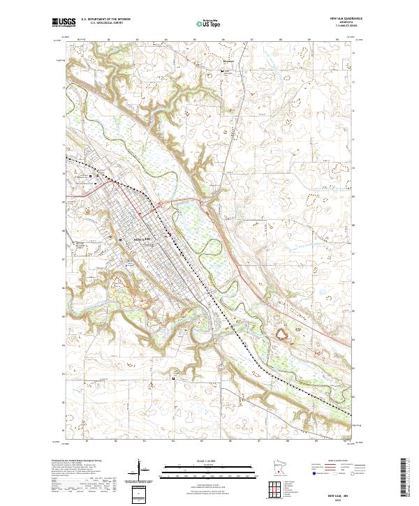 2022 New Ulm2022 Print · USGSIn this contemporary look at the Minnesota River valley, the regional center of New Ulm is shown in high detail alongside the northern settlement of Klossner. Genealogists can locate several key burial sites, including Saint Paul's Lutheran Cem and Saint Josephs Cem, or trace the grounds of Martin Luther College.
 - 2022 Map of Sanborn SE, 2022 Print
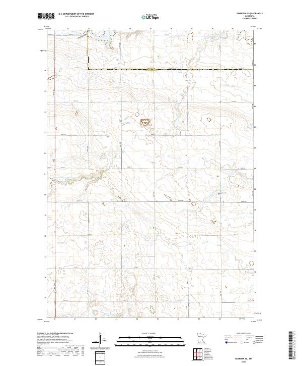 2022 Sanborn SE2022 Print · USGSSouthwestern Minnesota farmland on the Cottonwood and Brown County line appears in this recent study of the rural landscape. Genealogists and local historians can trace the course of the Little Cottonwood River or locate the Delton Cem and the unique Red Rock Dells.
 - 2022 Map of Sleepy Eye NW, 2022 Print
 2022 Sleepy Eye NW2022 Print · USGSThe Minnesota River valley comes alive in this survey, showcasing the convergence of three counties and the legacy of early settlements. Genealogists can locate Fort Ridgely State Cem, Golden Gate Cem, and the Loffelmacher Private Cem.
 - 2022 Map of Perth, 2022 Print
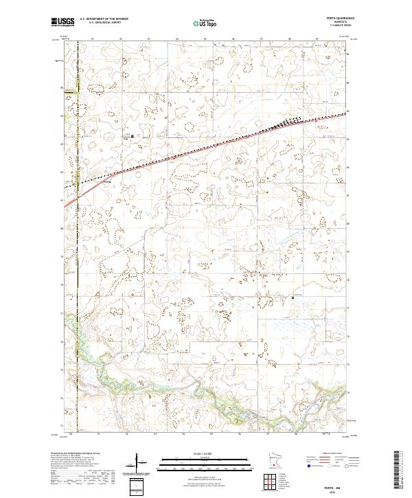 2022 Perth2022 Print · USGSSouthern Minnesota agricultural lands at the junction of three counties are detailed here in the early twenty-first century. Genealogists and local researchers can pinpoint the locations of North Lincoln Cem, Lincoln Cem, and the small settlement of Perth.
End of results
Showing maps 1-24 of 24
Top cities of Brown County
- New Ulm historical maps
- Sleepy Eye historical maps
- Springfield historical maps
- Hanska historical maps
- Stark historical maps
- Linden historical maps
See more
Frequently asked questions
- What are the different types of historical maps available for Brown County?
- What is the oldest map of Brown County?
- Where can I purchase historical maps of Brown County for my home or office?
- Where can I download high-res historical maps of Brown County?
- Are there historical topographic maps available for Brown County?
- Is there historical aerial imagery available for Brown County?
- Where are historical maps of Brown County sourced from?