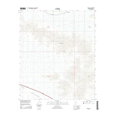
2014 Map of Estrella
USGS Topo · Published 2014About this map
The Maricopa Mountains dominate this region of the Sonoran Desert, providing a detailed look at the complex topography of the range before it levels out toward the Gila River valley. In the northern section of the map, the small settlement of Estrella sits along the route of W Maricopa Rd, marking a point of human activity in an otherwise high-elevation desert landscape. This 2014 survey illustrates the natural drainage patterns of the area, most notably Bender Wash, which cuts across the southwestern corner of the quadrangle. The map is primarily defined by its sharp relief and the transition from the rugged peaks of the central range to the alluvial fans and desert floor that characterize the Maricopa County interior.
Find a feature on this map
8 named features on this map. Tap any name to fly to it.
Don’t see what you’re looking for? This feature index may not catch every label — zoom into the map to look around manually.
Map Details
Editions of this 2014 Estrella Map
This is the sole edition of this map. No revisions or reprints were ever made.
Other maps of this area

1951 · Estrella
USGS Topo · 1:62,500

1951 · Gila Bend
USGS Topo · 1:62,500

1951 · Mobile
USGS Topo · 1:62,500

1951 · Cotton Center
USGS Topo · 1:62,500

1953 · Ajo
USGS Topo · 1:250,000

1954 · Phoenix
USGS Topo · 1:250,000

1957 · Ajo
USGS Topo · 1:250,000

1957 · Phoenix
USGS Topo · 1:250,000

1958 · Ajo
USGS Topo · 1:250,000

1958 · Phoenix
USGS Topo · 1:250,000