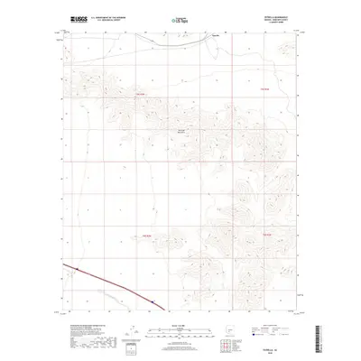
2018 Map of Estrella
USGS Topo · Published 2018About this map
Maricopa Mountains dominate the central landscape of this desert terrain, where deep ridgelines and steep elevation changes define the topography. In the northern reaches, the small settlement of Estrella sits along the roadway, serving as a primary point of human activity in an otherwise austere environment. The drainage of Bender Wash cuts across the southwestern corner of the sheet, illustrating the natural water-flow patterns that have shaped this arid region over time. The map provides a clear look at the intersection of natural features and modern transportation, specifically the corridor of 238 winding through the northern flats. This survey represents a specific moment in the land's management, detailing township and range boundaries such as t5s r2w and t6s r1w that organize this portion of the Arizona desert.
Find a feature on this map
8 named features on this map. Tap any name to fly to it.
Don’t see what you’re looking for? This feature index may not catch every label — zoom into the map to look around manually.
Map Details
Editions of this 2018 Estrella Map
This is the sole edition of this map. No revisions or reprints were ever made.
Other maps of this area

1951 · Estrella
USGS Topo · 1:62,500

1951 · Gila Bend
USGS Topo · 1:62,500

1951 · Mobile
USGS Topo · 1:62,500

1951 · Cotton Center
USGS Topo · 1:62,500

1953 · Ajo
USGS Topo · 1:250,000

1954 · Phoenix
USGS Topo · 1:250,000

1957 · Ajo
USGS Topo · 1:250,000

1957 · Phoenix
USGS Topo · 1:250,000

1958 · Ajo
USGS Topo · 1:250,000

1958 · Phoenix
USGS Topo · 1:250,000