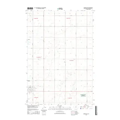
2015 Map of Eureka East
USGS Topo · Published 2015About this map
Eureka serves as the focal point for this landscape in McPherson County, where the town's street grid, including B Ave and 3rd St, gives way to a sprawling rural territory organized by the Public Land Survey System. The area is defined by its numerous prairie potholes and wetlands, highlighted by the extensive McPherson County Waterfowl Production Area and several smaller Mcwpa tracts. These features indicate the region's importance for local conservation and migratory wildlife. For those researching family history in the Great Plains, the presence of the Zion Cem and Aman Cem provides specific points of interest for genealogical study. The terrain is further etched by Spring Cr in the northwest, while a network of county roads like CR-3a and section-line routes such as 331st Ave connect the dispersed farmsteads across the township ranges.
Find a feature on this map
39 named features on this map. Tap any name to fly to it.
Don’t see what you’re looking for? This feature index may not catch every label — zoom into the map to look around manually.
Map Details
Editions of this 2015 Eureka East Map
This is the sole edition of this map. No revisions or reprints were ever made.
Other maps of this area

1954 · Aberdeen
USGS Topo · 1:250,000

1956 · Aberdeen
USGS Topo · 1:250,000

1978 · Wolff Lake
USGS Topo · 1:24,000

1978 · Greenway
USGS Topo · 1:24,000

1978 · Hosmer NW
USGS Topo · 1:24,000

1978 · Eureka West
USGS Topo · 1:24,000

1978 · Venturia
USGS Topo · 1:24,000

1978 · Feinstein Lake
USGS Topo · 1:24,000

1978 · Eureka East
USGS Topo · 1:24,000

1978 · Schumacher Lake SW
USGS Topo · 1:24,000