
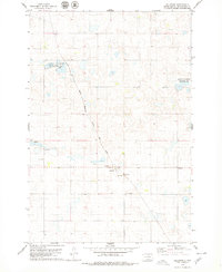
1978 Map of Eureka East
USGS Topo · Published 1979About this map
Eureka serves as the primary hub on this prairie landscape, where the C M St P & P railroad line enters the town from the south. The surrounding terrain in McPherson County is characterized by numerous depressions and wetlands, many of which are protected within the National Waterfowl Production Area. This conservation focus is a defining element of the local geography, alongside the agricultural and extraction activities evidenced by various Gravel Pits scattered across the township lines. Genealogists and local historians can locate several burial sites, including Aman Cem and Zion Cem, providing specific points of interest for family research. The community's social and recreational layout is further detailed by the presence of a Golf Course situated on the outskirts of the main settlement, while Spring Cr provides a natural drainage feature in the northwestern corner of the quadrangle.
Find a feature on this map
10 named features on this map. Tap any name to fly to it.
Don’t see what you’re looking for? This feature index may not catch every label — zoom into the map to look around manually.
Map Details
Editions of this 1978 Eureka East Map
This is the sole edition of this map. No revisions or reprints were ever made.
Other maps of this area

1954 · Aberdeen
USGS Topo · 1:250,000

1956 · Aberdeen
USGS Topo · 1:250,000

1978 · Wolff Lake
USGS Topo · 1:24,000

1978 · Greenway
USGS Topo · 1:24,000

1978 · Hosmer NW
USGS Topo · 1:24,000

1978 · Eureka West
USGS Topo · 1:24,000

1978 · Venturia
USGS Topo · 1:24,000

1978 · Feinstein Lake
USGS Topo · 1:24,000

1978 · Schumacher Lake SW
USGS Topo · 1:24,000
1978 · Hillsview
USGS Topo · 1:24,000