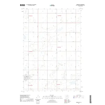
2017 Map of Eureka East
USGS Topo · Published 2017About this map
Eureka anchors the southwestern corner of this McPherson County landscape, showcasing its organized street grid including Harrison Ave, F Ave, and L Ave. The surrounding terrain is defined by the Public Land Survey System sections of the early 21st century, with the transition between t127n r73w and t127n r72w marking a region of numerous small prairie potholes and wetlands. To the northeast, the Aman Cem sits isolated within the agricultural section lines, a small but vital landmark for genealogists and local historians. This survey by the U.S. Geological Survey captures the modern road network, where gravel routes like 331st Ave and Co Hwy 8 navigate the glaciated terrain north of the town center, while Spring Cr meanders through the northwestern corner.
Find a feature on this map
33 named features on this map. Tap any name to fly to it.
Don’t see what you’re looking for? This feature index may not catch every label — zoom into the map to look around manually.
Map Details
Editions of this 2017 Eureka East Map
This is the sole edition of this map. No revisions or reprints were ever made.
Other maps of this area

1954 · Aberdeen
USGS Topo · 1:250,000

1956 · Aberdeen
USGS Topo · 1:250,000

1978 · Wolff Lake
USGS Topo · 1:24,000

1978 · Greenway
USGS Topo · 1:24,000

1978 · Hosmer NW
USGS Topo · 1:24,000

1978 · Eureka West
USGS Topo · 1:24,000

1978 · Venturia
USGS Topo · 1:24,000

1978 · Feinstein Lake
USGS Topo · 1:24,000

1978 · Eureka East
USGS Topo · 1:24,000

1978 · Schumacher Lake SW
USGS Topo · 1:24,000