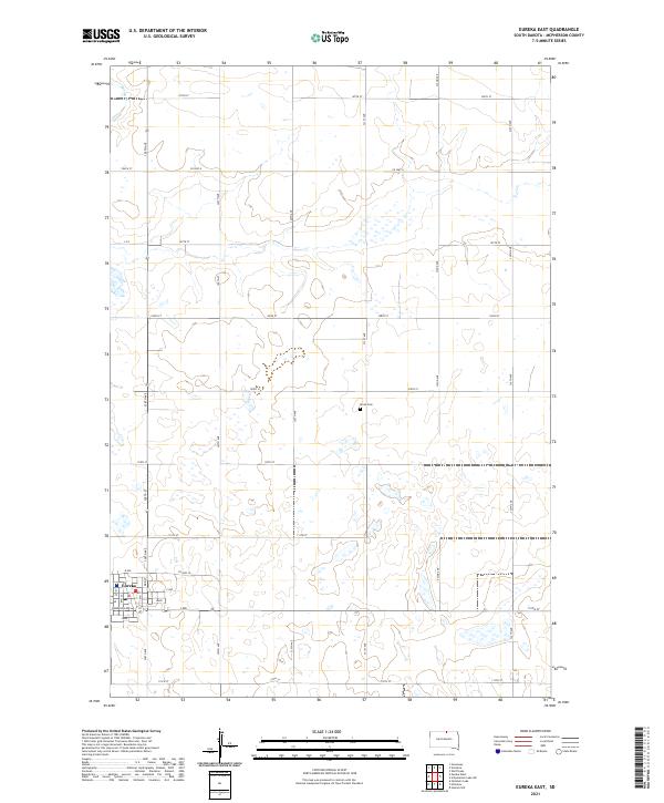
2021 Map of Eureka East
USGS Topo · Published 2021About this map
The prairie landscape of McPherson County is dominated by the town of Eureka and the surrounding agricultural grid. This portion of the county reflects a deeply organized township and range system, where roads like Co Hwy 8 and Co Hwy 3a follow section lines across a terrain marked by numerous small depressions and seasonal wetlands. The eastern edge of Eureka is clearly defined, with a concentration of streets including Harrison Ave and L Ave transitioning into the broader rural expanses of Township 127 North. Near the center of the quadrangle, the Aman Cem serves as a small but significant historical landmark for local genealogists. In the northwestern corner, Spring Cr provides a subtle natural deviation from the otherwise straight-edged human geometry of the South Dakota plains.
Find a feature on this map
32 named features on this map. Tap any name to fly to it.
Don’t see what you’re looking for? This feature index may not catch every label — zoom into the map to look around manually.
Map Details
Editions of this 2021 Eureka East Map
This is the sole edition of this map. No revisions or reprints were ever made.
Other maps of this area

1954 · Aberdeen
USGS Topo · 1:250,000

1956 · Aberdeen
USGS Topo · 1:250,000

1978 · Wolff Lake
USGS Topo · 1:24,000

1978 · Greenway
USGS Topo · 1:24,000

1978 · Hosmer NW
USGS Topo · 1:24,000

1978 · Eureka West
USGS Topo · 1:24,000

1978 · Venturia
USGS Topo · 1:24,000

1978 · Feinstein Lake
USGS Topo · 1:24,000

1978 · Eureka East
USGS Topo · 1:24,000

1978 · Schumacher Lake SW
USGS Topo · 1:24,000