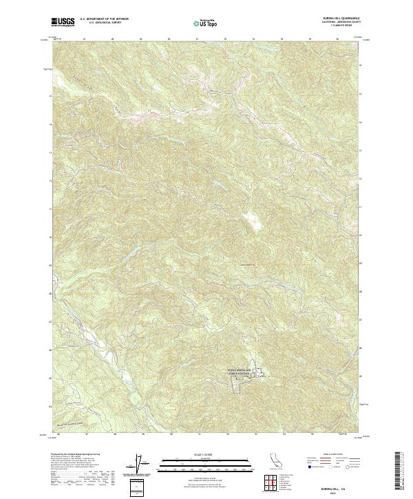
2021 Map of Eureka Hill
USGS Topo · Published 2021About this map
Eureka Hill serves as the focal point for this section of coastal Mendocino County, where the terrain is defined by a dense network of ridges and watercourses. The landscape is dominated by the Garcia River and its major tributary, the N Fork Garcia River, which carve through the steep topography. Significant elevations such as Adams Ridge and the distinct clearing at Jacks Opening provide landmarks within the heavily dissected terrain. A network of primitive and local roads, including Mountain View Rd and Garcia River Rd, trace the natural contours of the hills, connecting isolated points across the township lines of T13N and T12N. In the southern portion of the quadrangle, the headwaters of North Fork Schooner Gulch and Rolling Brook highlight the intricate drainage patterns that characterize this region of the California coast.
Find a feature on this map
28 named features on this map. Tap any name to fly to it.
Don’t see what you’re looking for? This feature index may not catch every label — zoom into the map to look around manually.
Map Details
Editions of this 2021 Eureka Hill Map
This is the sole edition of this map. No revisions or reprints were ever made.
Other maps of this area

1943 · Point Arena
USGS Topo · 1:62,500

1943 · Boonville
USGS Topo · 1:62,500

1943 · Navarro
USGS Topo · 1:62,500

1943 · Ornbaun
USGS Topo · 1:62,500

1944 · Saddle Point
USGS Topo · 1:62,500

1944 · Ornbaun
USGS Topo · 1:62,500

1947 · Santa Rosa
USGS Topo · 1:250,000

1949 · Santa Rosa
USGS Topo · 1:250,000

1957 · Ukiah
USGS Topo · 1:250,000

1958 · Santa Rosa
USGS Topo · 1:250,000