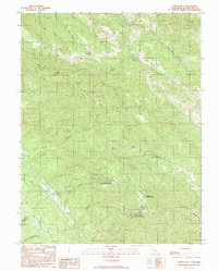
1991 Map of Eureka Hill
USGS Topo · Published 1991About this map
The Point Arena Air Force Station and associated Military Reservation dominate the southern uplands of this coastal California landscape, providing a specialized look at Cold War-era infrastructure in Mendocino County. The terrain is defined by the steep drainage of the Garcia River and its North Fork Garcia River, which cut through a complex network of ridges like Zeni Ridge. Small tributary systems such as Rolling Brook and Lee Creek flow through the interior, while the northern reaches are marked by the headwaters of Brush Creek and its southern fork. The presence of Jacks Opening and the eponymous Eureka Hill suggest localized clearing and historical landmarks within the dense topography. This 1991 provisional edition reflects 1980s aerial data, capturing the footprint of the air station and the surrounding timber and watershed geography before more modern shifts in land management.
Find a feature on this map
18 named features on this map. Tap any name to fly to it.
Don’t see what you’re looking for? This feature index may not catch every label — zoom into the map to look around manually.
Map Details
Editions of this 1991 Eureka Hill Map
This is the sole edition of this map. No revisions or reprints were ever made.
Other maps of this area

1943 · Point Arena
USGS Topo · 1:62,500

1943 · Boonville
USGS Topo · 1:62,500

1943 · Navarro
USGS Topo · 1:62,500

1943 · Ornbaun
USGS Topo · 1:62,500

1944 · Saddle Point
USGS Topo · 1:62,500

1944 · Ornbaun
USGS Topo · 1:62,500

1947 · Santa Rosa
USGS Topo · 1:250,000

1949 · Santa Rosa
USGS Topo · 1:250,000

1957 · Ukiah
USGS Topo · 1:250,000

1958 · Santa Rosa
USGS Topo · 1:250,000