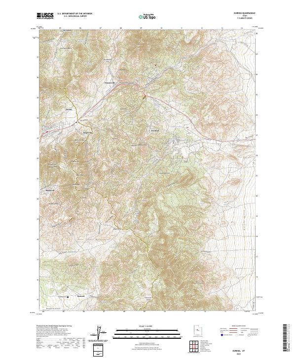
2023 Map of Eureka
USGS Topo · Published 2023About this map
The East Tintic Mountains serve as the backdrop for this look at one of Utah's most significant mineral belts. The terrain is marked by the complex network of mining history, with roads like Haulage Rd and Leadville Row hinting at the industrial activity that defined the district. Settlements such as Eureka and Mammoth are positioned among prominent peaks like Godiva Mtn and Mammoth Peak, while the more isolated Diamond and Knightville appear along the southern and eastern slopes. A legacy of the region's people is found at the Diamond Cem near the southern edge of the quadrangle.
Find a feature on this map
128 named features on this map. Tap any name to fly to it.
Don’t see what you’re looking for? This feature index may not catch every label — zoom into the map to look around manually.
Map Details
Editions of this 2023 Eureka Map
This is the sole edition of this map. No revisions or reprints were ever made.
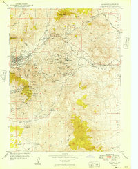
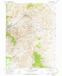
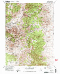
Historical Maps of Diamond Through Time
4 maps found