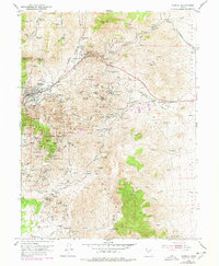
1954 Map of Eureka
USGS Topo · Published 1978About this map
Mining operations and mountain settlements define this portion of the East Tintic Mountains during the mid-20th century. The city of Eureka serves as the primary hub, surrounded by a dense network of shafts and claims such as Iron Blossom No 1, Dragon Mine, and the Treasure Hill workings. The landscape is marked by industrial infrastructure, including the Chief Lime Plant and several Lime Quarries near Homansville. Smaller company towns and camps like Knightville, Mammoth, and Dividend are linked by the Denver and Rio Grande Western railroad and early automotive routes like Telephone Road. High peaks including Mammoth Peak and Sioux Peak overlook a terrain carved by Dragon Canyon and Pinyon Canyon, where numerous springs like Hidden Treasure Spring provided critical water for the district's residents and laborers.
Find a feature on this map
148 named features on this map. Tap any name to fly to it.
Don’t see what you’re looking for? This feature index may not catch every label — zoom into the map to look around manually.
Map Details
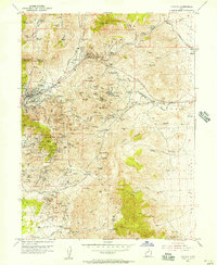
Editions of this 1954 Eureka Map
2 editions found
Other maps of this area

1885 · Salt Lake
USGS Topo · 1:250,000

1885 · Manti
USGS Topo · 1:250,000

1885 · Sevier Desert
USGS Topo · 1:250,000

1885 · Tooele Valley
USGS Topo · 1:250,000

1895 · Manti
USGS Topo · 1:250,000

1947 · Fivemile Pass
USGS Topo · 1:62,500

1947 · Allens Ranch
USGS Topo · 1:24,000

1947 · Boulter Peak
USGS Topo · 1:24,000

1949 · Eureka
USGS Topo · 1:24,000

1949 · Allens Ranch
USGS Topo · 1:24,000