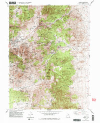
1992 Map of Eureka
USGS Topo · Published 1992About this map
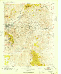
Eureka serves as the industrial and social anchor of this 1992 landscape, situated at the base of Eureka Ridge in the northern Tintic Mountains. The map reveals a complex web of extraction history across Godiva Mountain and the surrounding canyons, where numerous legacy workings like the Mammoth Shaft and the Iron King No 1 Tunnel are recorded. While Eureka and Mammoth remain active points on the map, the presence of several locations marked as sites—such as Knightville, Homansville, and Diamond—indicates the shifting footprint of the mining boom. Transportation history is etched into the terrain by the Union Pacific Railroad Grade, which once connected these high-altitude operations to the broader valley. From the educational hub at Tintic High School to the quiet corner of the Cemetery, the map documents a community deeply intertwined with the geology of the Goshen Valley fringe.
Find a feature on this map
71 named features on this map. Tap any name to fly to it.
Don’t see what you’re looking for? This feature index may not catch every label — zoom into the map to look around manually.
Map Details
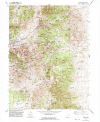
Editions of this 1992 Eureka Map
2 editions found
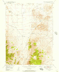
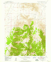
Other maps of this area

1885 · Salt Lake
USGS Topo · 1:250,000

1885 · Manti
USGS Topo · 1:250,000

1885 · Sevier Desert
USGS Topo · 1:250,000

1885 · Tooele Valley
USGS Topo · 1:250,000

1895 · Manti
USGS Topo · 1:250,000

1947 · Fivemile Pass
USGS Topo · 1:62,500
1947 · Allens Ranch
USGS Topo · 1:24,000
1947 · Boulter Peak
USGS Topo · 1:24,000
1949 · Eureka
USGS Topo · 1:24,000

1949 · Allens Ranch
USGS Topo · 1:24,000