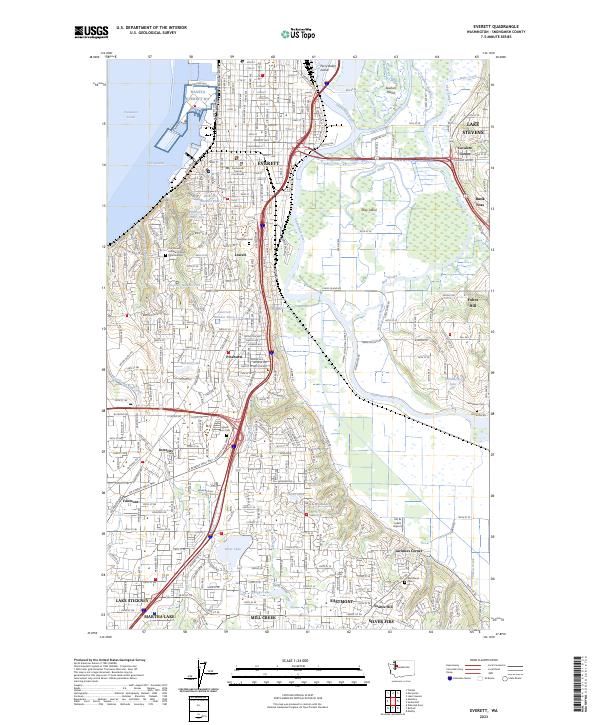
2023 Map of Everett
USGS Topo · Published 2023About this map
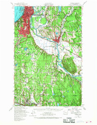
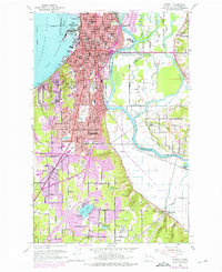
Everett occupies the heart of this Snohomish County survey, showing the city's complex relationship with the delta formed by the Snohomish River and its numerous distributaries like Ebey Slough and Steamboat Slough. The landscape is a mix of dense residential growth and preserved maritime industrial space, anchored by the NAVSTA Everett WA facility on Port Gardner. Significant local history is preserved in landmarks such as the Snohomish County Courthouse and a series of burial grounds including Evergreen Cem and Woodlawn Cem.
Find a feature on this map
69 named features on this map. Tap any name to fly to it.
Don’t see what you’re looking for? This feature index may not catch every label — zoom into the map to look around manually.
Map Details
Editions of this 2023 Everett Map
This is the sole edition of this map. No revisions or reprints were ever made.
Historical Maps of Westmont Through Time
4 maps found