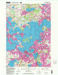
1997 Map of Excelsior
USGS Topo · Published 1999About this map
Lake Minnetonka dominates this late-twentieth-century landscape, its intricate shoreline of bays and points defining the development patterns of Excelsior, Wayzata, and Deephaven. The map shows a region heavily shaped by leisure and suburban growth, featuring numerous private clubs such as the Woodhill Country Club and Orono Country Club. This era of the lake's history is characterized by dense residential peninsulas like Minnetonka Beach and Casco Point, contrasted with protected natural areas like the Wolsfeld Woods State Scientific and Natural Area. Local infrastructure is well-established, with institutional anchors including Orono High School and several cemeteries such as Woodside Cemetery. The Soo Line corridor remains a prominent feature, tracing the northern edge of the lake through Spring Park and toward the metropolitan center, illustrating the historical transit links that originally established these lakeside communities.
Find a feature on this map
104 named features on this map. Tap any name to fly to it.
Don’t see what you’re looking for? This feature index may not catch every label — zoom into the map to look around manually.
Map Details
Editions of this 1997 Excelsior Map
This is the sole edition of this map. No revisions or reprints were ever made.
Other maps of this area

1896 · Minneapolis
USGS Topo · 1:62,500

1901 · Minneapolis
USGS Topo · 1:62,500

1902 · Anoka
USGS Topo · 1:62,500

1905 · Minnetonka
USGS Topo · 1:62,500

1907 · Minnetonka
USGS Topo · 1:62,500

1909 · Rockford
USGS Topo · 1:62,500

1953 · Saint Paul
USGS Topo · 1:250,000

1953 · Stillwater
USGS Topo · 1:250,000

1954 · Hopkins
USGS Topo · 1:24,000

1954 · Eden Prairie
USGS Topo · 1:24,000