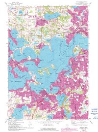
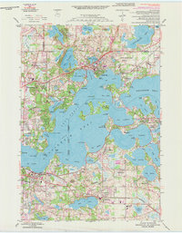
1958 Map of Excelsior
USGS Topo · Published 1993About this map
Lake Minnetonka dominates this 1950s landscape, its intricate shoreline and many islands defining the residential and recreational development of the western Twin Cities suburbs. The 1993 revisions shown in purple highlight the significant post-war expansion of Minnetonka, Shorewood, and Chanhassen, where former open lands were rapidly converted to suburban housing. The map details a sophisticated network of lakeside communities including Minnetonka Beach, Deephaven, and Wayzata, which maintain their identity despite the encroaching urban sprawl. Institutional anchors like Orono High School and Woodhill Country Club appear alongside the expansive Big Island, illustrating the area's transition from seasonal resort destination to permanent year-round residential hub. Local landmarks such as Resurrection Cemetery and the Lafayette Country Club provide essential points of reference for genealogists tracing family roots in this affluent lake district.
Find a feature on this map
99 named features on this map. Tap any name to fly to it.
Don’t see what you’re looking for? This feature index may not catch every label — zoom into the map to look around manually.
Map Details
Editions of this 1958 Excelsior Map
5 editions found
Other maps of this area

1896 · Minneapolis
USGS Topo · 1:62,500

1901 · Minneapolis
USGS Topo · 1:62,500

1902 · Anoka
USGS Topo · 1:62,500

1905 · Minnetonka
USGS Topo · 1:62,500

1907 · Minnetonka
USGS Topo · 1:62,500

1909 · Rockford
USGS Topo · 1:62,500

1953 · Saint Paul
USGS Topo · 1:250,000

1953 · Stillwater
USGS Topo · 1:250,000

1954 · Hopkins
USGS Topo · 1:24,000

1954 · Eden Prairie
USGS Topo · 1:24,000