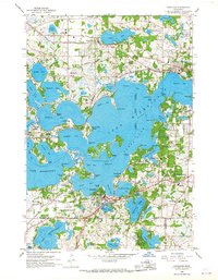
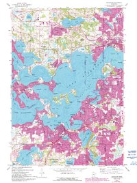
1958 Map of Excelsior
USGS Topo · Published 1967About this map
Lake Minnetonka dominates this late-1950s landscape, its intricate shoreline of bays and points defining the development of surrounding communities like Excelsior and Wayzata. The map detail reveals a specialized suburban and recreational geography, featuring several private clubs such as the Wayzata Country Club, Minnetonka Country Club, and the Lafayette Country Club. These social hubs are interspersed with local institutions including the Minnewashta Sch and Trinity Ch. Transportation is anchored by the Great Northern and the Minneapolis and St Louis railroads, which cut through the lakeside terrain. A notable cultural artifact of the era is the Drive-in Theater located near the eastern edge. The complex hydrography includes smaller bodies of water like Christmas Lake and Minnewashta Lake, separated from the main lake by the rolling topography of Shorewood and Chanhassen.
Find a feature on this map
96 named features on this map. Tap any name to fly to it.
Don’t see what you’re looking for? This feature index may not catch every label — zoom into the map to look around manually.
Map Details
Editions of this 1958 Excelsior Map
5 editions found
Other maps of this area

1896 · Minneapolis
USGS Topo · 1:62,500

1901 · Minneapolis
USGS Topo · 1:62,500

1902 · Anoka
USGS Topo · 1:62,500

1905 · Minnetonka
USGS Topo · 1:62,500

1907 · Minnetonka
USGS Topo · 1:62,500

1909 · Rockford
USGS Topo · 1:62,500

1953 · Saint Paul
USGS Topo · 1:250,000

1953 · Stillwater
USGS Topo · 1:250,000

1954 · Hopkins
USGS Topo · 1:24,000

1954 · Eden Prairie
USGS Topo · 1:24,000