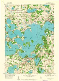
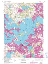
1958 Map of Excelsior
USGS Topo · Published 1959About this map
Lake Minnetonka dominates this landscape, its intricate shoreline defining the growth of lakeside communities like Wayzata, Deephaven, and Minnetonka Beach. By the late 1950s, the region was established as a premier recreational and residential destination, evidenced by the numerous country clubs such as Woodhill Country Club and Minnetonka Country Club. The geography is characterized by deep bays and prominent points, including Lafayette Bay, Crystal Bay, and Huntington Point, which shaped the early development of private estates and seasonal retreats.
Find a feature on this map
95 named features on this map. Tap any name to fly to it.
Don’t see what you’re looking for? This feature index may not catch every label — zoom into the map to look around manually.
Map Details
Editions of this 1958 Excelsior Map
5 editions found
Other maps of this area

1896 · Minneapolis
USGS Topo · 1:62,500

1901 · Minneapolis
USGS Topo · 1:62,500

1902 · Anoka
USGS Topo · 1:62,500

1905 · Minnetonka
USGS Topo · 1:62,500

1907 · Minnetonka
USGS Topo · 1:62,500

1909 · Rockford
USGS Topo · 1:62,500

1953 · Saint Paul
USGS Topo · 1:250,000

1953 · Stillwater
USGS Topo · 1:250,000

1954 · Hopkins
USGS Topo · 1:24,000

1954 · Eden Prairie
USGS Topo · 1:24,000