2022 Map of Fairbank
USGS Topo · Published 2022About this map
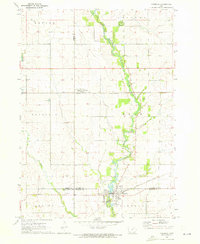
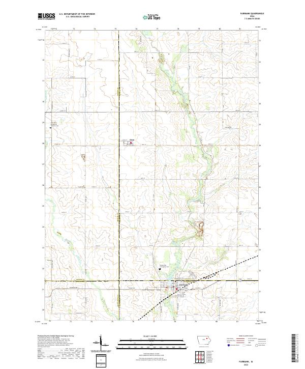
The Little Wapsipinicon River meanders through this agricultural landscape where four counties — Bremer, Black Hawk, Buchanan, and Fayette — converge. The settlement of Fairbank sits at this administrative junction, serving as a hub for the surrounding rural townships of T91N R10W and T90N R10W. To the north, the smaller village of Oran anchors the northwestern corner of the quadrangle. Local genealogy and community history are anchored by several established burial grounds, including the Saint Peter Evangelical Lutheran Cem on the western edge and both the Immaculate Conception Cem and Fairbank Cem near the river. The terrain is defined by a dense grid of section roads, including Co Hwy V62 and Co Rd V3C, which connect these dispersed farmsteads to the central watercourse and nearby tributaries like Buck Cr.
Find a feature on this map
63 named features on this map. Tap any name to fly to it.
Don’t see what you’re looking for? This feature index may not catch every label — zoom into the map to look around manually.
Map Details
Editions of this 2022 Fairbank Map
This is the sole edition of this map. No revisions or reprints were ever made.