Loading...
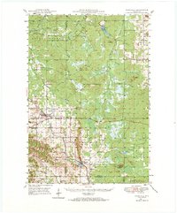
Loading map...1948 Map of Fairchild
USGS Topo · Published 1984About this map
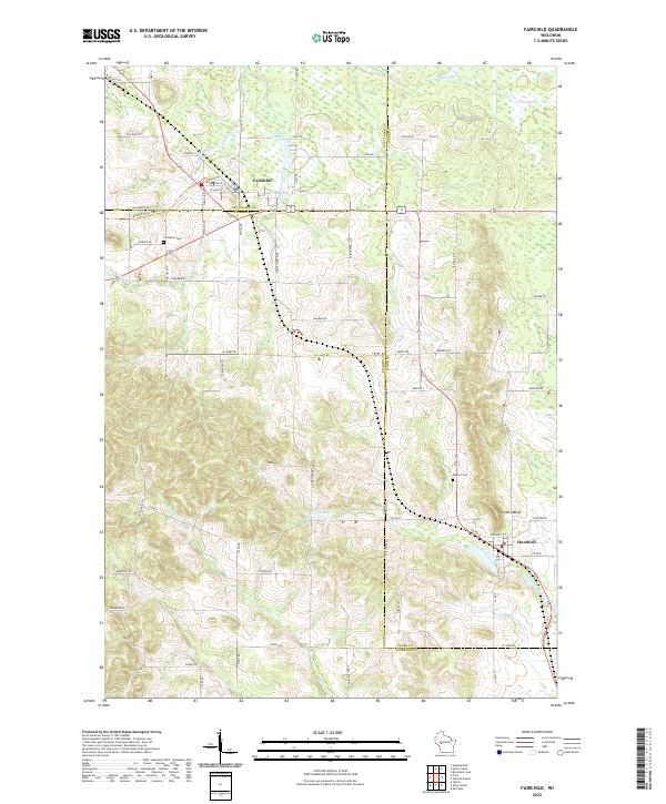
Fairchild and Humbird anchor this West-Central Wisconsin landscape where Eau Claire, Clark, and Jackson Counties converge. The Chicago and North Western railroad corridor dictates the settlement pattern, connecting these villages with the smaller outpost of Tioga to the northeast. The terrain is defined by distinct glacial features and sandstone remnants, notably Humbird Bluff and the massive Wildcat Mound, which rise above the surrounding wetlands and creek systems like Fivemile Creek.
Find a feature on this map
52 named features on this map. Tap any name to fly to it.
Don’t see what you’re looking for? This feature index may not catch every label — zoom into the map to look around manually.
Map Details
Date Portrayed1948
Date Published1984
PublisherU.S. Geological Survey
Map TypeTopographic
Scale1:62,500
Physical Dimensions18.43 x 22.21 inches
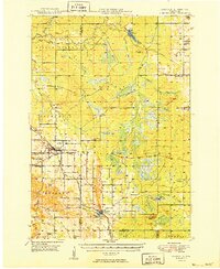
Editions of this 1948 Fairchild Map
2 editions found
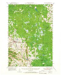
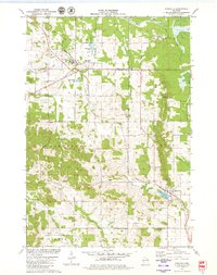
Historical Maps of Fairchild Through Time
4 maps found
Featured Locations
Source Details
SourceU.S. Geological Survey
CopyrightPublic Domain