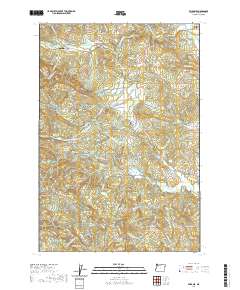
2020 Map of Fairdale
USGS Topo · Published 2020About this map
Moores Valley and its namesake Moores Valley Cemetery serve as the quiet heart of this Yamhill County landscape. The area is defined by a complex network of forest roads and reservoirs that reflect a history of timber management and water resource development. At the northern edge, Fairdale Mineral Spring and Homestead Ridge sit near the winding course of the North Yamhill River. The map reveals a specialized local infrastructure, including the Flying M Airport and its adjacent Flying M Reservoir, alongside numerous family-named landmarks like Puddy Gulch and Hutchcroft Creek. Rugged topography is dominated by peaks such as Kutch Mountain and Slide Mountain, while legacy transportation routes like NW Old Railroad Grade Road and NW Old Wagon Road provide clues to early passage through the Coast Range foothills.
Find a feature on this map
93 named features on this map. Tap any name to fly to it.
Don’t see what you’re looking for? This feature index may not catch every label — zoom into the map to look around manually.
Map Details
Editions of this 2020 Fairdale Map
This is the sole edition of this map. No revisions or reprints were ever made.
Other maps of this area

1924 · Mc Minnville
USGS Topo · 1:48,000

1926 · Mc Minnville
USGS Topo · 1:62,500

1940 · McMinnville
USGS Topo · 1:62,500

1941 · Yamhill
USGS Topo · 1:62,500

1942 · Sheridan
USGS Topo · 1:62,500

1942 · Yamhill
USGS Topo · 1:62,500

1942 · Fairdale
USGS Topo · 1:62,500

1948 · Vancouver
USGS Topo · 1:250,000

1950 · Vancouver
USGS Topo · 1:250,000

1950 · Vancouver
USGS Topo · 1:250,000