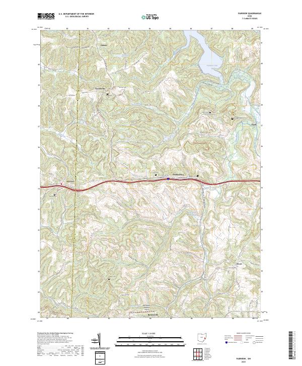
2023 Map of Fairview
USGS Topo · Published 2023About this map
Piedmont Lake dominates the northeastern corner of this landscape, its fingers reaching into the hilly terrain along the border of Guernsey and Belmont Counties. This territory is defined by its rural settlements and dispersed burial grounds, including Sewellsville Cem and the Old Egypt Cem near the eastern margin. The village of Fairview sits at a crossroads in the west, while the southern reaches are marked by the Bradfield Airport near Barnesville. Waterways like Stillwater Creek and Spencer Creek carve through the topography, reflecting a landscape where development is constrained by the winding creek valleys and ridges. Smaller hamlets like Hendrysburg, Egypt, and Olivett are connected by a network of township roads, such as Styx Hill Rd and Skull Fork Rd, that trace the high ground between the various runs and forks.
Find a feature on this map
86 named features on this map. Tap any name to fly to it.
Don’t see what you’re looking for? This feature index may not catch every label — zoom into the map to look around manually.
Map Details
Editions of this 2023 Fairview Map
This is the sole edition of this map. No revisions or reprints were ever made.
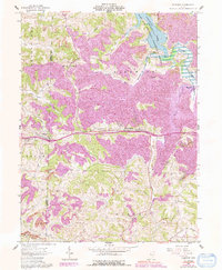
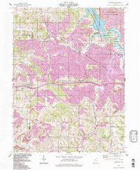
Historical Maps of Egypt Through Time
3 maps found