Loading...
Loading map...2021 Map of Faith
USGS Topo · Published 2021About this map
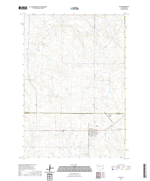
Faith serves as the primary hub of this high plains landscape at the border of Meade and Perkins Counties. The town's grid is clearly defined, with the Faith Municipal Airport situated to the northeast and essential local institutions such as Saint Joseph Cem and Faith Cem located along the outskirts. These landmarks provide vital reference points for genealogists tracing family histories in the western South Dakota region.
Find a feature on this map
33 named features on this map. Tap any name to fly to it.
Don’t see what you’re looking for? This feature index may not catch every label — zoom into the map to look around manually.
Map Details
Date Portrayed2021
Date Published2021
PublisherU.S. Geological Survey
Map TypeTopographic
Scale1:24000
Physical Dimensions24 x 29 inches
Editions of this 2021 Faith Map
This is the sole edition of this map. No revisions or reprints were ever made.
Historical Maps of Faith Through Time
Featured Locations
Source Details
SourceU.S. Geological Survey
CopyrightPublic Domain