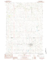
1983 Map of Faith
USGS Topo · Published 1984About this map
Faith anchors the southern portion of this West River landscape, serving as a vital hub where the Perkins Co Meade Co line meets. The town's layout reflects its role in the regional ranching economy, featuring the Faith Municipal Landing Field and infrastructure like the Underground Reservoir. Family and local history is preserved at St Joseph Cem and Faith Cem, providing essential points of interest for genealogists tracing early residents of these plains.
Find a feature on this map
13 named features on this map. Tap any name to fly to it.
Don’t see what you’re looking for? This feature index may not catch every label — zoom into the map to look around manually.
Map Details
Editions of this 1983 Faith Map
This is the sole edition of this map. No revisions or reprints were ever made.
Other maps of this area

1951 · Redelm NW
USGS Topo · 1:24,000

1951 · Faith NE
USGS Topo · 1:24,000

1952 · Faith NW
USGS Topo · 1:24,000

1953 · Rapid City
USGS Topo · 1:250,000

1953 · McIntosh
USGS Topo · 1:250,000

1954 · Lemmon
USGS Topo · 1:250,000

1954 · Pierre
USGS Topo · 1:250,000

1957 · Lemmon
USGS Topo · 1:250,000

1957 · Rapid City
USGS Topo · 1:250,000

1958 · Pierre
USGS Topo · 1:250,000