2023 Map of Fall City
USGS Topo · Published 2023About this map
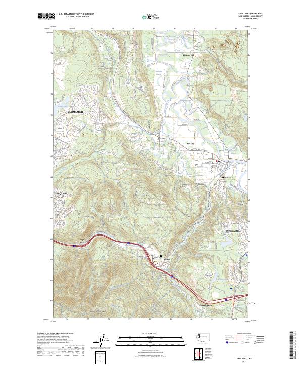
The Snoqualmie River and Raging River converge near the settlement of Fall City, defining a landscape where valley lowlands meet the rising elevations of West Tiger Mtn. This modern survey documents the dense network of rural roads and residential expansion stretching from Sammamish and Issaquah in the west toward the historic milling community of Preston. The map captures the distinct topography of the region, from the wetlands of Green Slough and Stickney Slough to the prominent heights of Grand Ridge and Mitchell Hill. Genealogists and local historians can locate the Fall City Cem and Preston Cem, along with the Preston Mill Pond, which serves as a reminder of the area's industrial past. The inclusion of Upper Preston and High Point illustrates the scattered nature of early foothills settlements as they transitioned into the contemporary suburbs of King County.
Find a feature on this map
159 named features on this map. Tap any name to fly to it.
Don’t see what you’re looking for? This feature index may not catch every label — zoom into the map to look around manually.
Map Details
Editions of this 2023 Fall City Map
This is the sole edition of this map. No revisions or reprints were ever made.