Old Maps of Snoqualmie, Washington
Explore 18 old maps of Snoqualmie, spanning from 1921 to today. These high-resolution historic maps reveal how streets, neighborhoods, landmarks, and natural features evolved over time — perfect for genealogy, metal detecting, research, and local history exploration.
What you can do with these maps:
- See how Snoqualmie changed over time: Compare historical maps to modern-day views to trace roads, homesites, rail lines & more.
- View detailed metadata: Each map includes creators, publishers, year, scale, and archive source.
- Overlay maps with satellite & LiDAR: Visualize the past alongside modern tools to explore terrain & human change.
- Trusted historical sources: Maps sourced from the USGS, Library of Congress, and other archives.
- Access maps your way: View online, download high-res files, or order prints for personal or research use.
Start exploring old maps of Snoqualmie to uncover forgotten places, hidden landmarks, and the deep history beneath your feet.
Snoqualmie, WA maps
(18)- 1921 Map of Sultan
 1921 Sultan1921 Print · USGSThe Snoqualmie and Skykomish river valleys are defined by timber and rail in the 1920s. Researchers can trace early industry through the Apex Mines, Coke Ovens, and rural schools like Mountain View School.4 unique versions available
 - 1923 Map of Sultan
 1923 Sultan1923 Print · USGSThe Skykomish and Snoqualmie river valleys thrive in the early twenties as centers of timber and rail. Genealogists can trace family roots through rural sites like Forest Glade School or follow the Lumber RR lines to the Apex Mines.4 unique versions available
 - 1953 Map of Snoqualmie, 1955 Print
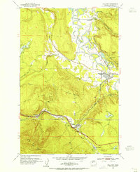
 1953 Snoqualmie1955 Print · USGSThe Snoqualmie Valley in the early fifties shows a bustling hub of timber and rail operations centered around the river forks. Researchers can trace the massive Lumber Mill and Powerhouse near Snoqualmie Falls or find local landmarks like Mt Si High Sch.5 unique versions available
 - 1953 Map of Fall City, 1955 Print
 1953 Fall City1955 Print · USGSKing County's river valleys and timbered ridges are captured here during the 1950s, showing the intersection of rail and river life. Genealogists and historians can trace the foundations of Fall City and Preston, or locate the Reynolds Mine and Fall City Cemetery.5 unique versions available
 - 1957 Map of Wenatchee, 1973 Print
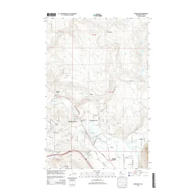
 1957 Wenatchee1973 Print · USGSThe northern Cascades and Columbia River valley appear here in the mid-fifties, showing the region's critical rail and transit corridors. Researchers can trace the routes of the Great Northern RR and Milwaukee Road through settlements like Skykomish, Baring, and Dryden.2 unique versions available
 - 1975 Map of Skykomish River, 1977 Print
 1975 Skykomish River1977 Print · USGSThe Cascades meet the river valleys in the mid-seventies, showing the vital rail corridors and mountain towns along the Skykomish River. Researchers can trace the path of the Pacific Crest National Scenic Trail and locate historic sites like State Reformatory Farm No 2 and the Old Cascade Tunnel.2 unique versions available
 - 1993 Map of Snoqualmie
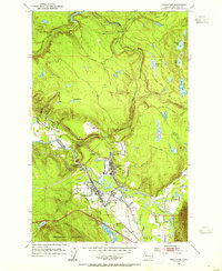
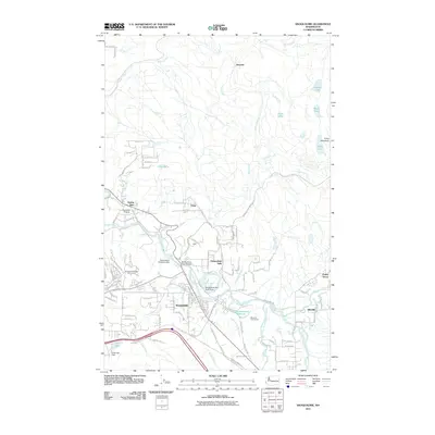
 1993 Snoqualmie1993 Print · USGSSnoqualmie and North Bend are documented in the early nineties, showing a landscape defined by timber milling and river power. Researchers can trace the legacy of the Lumber Mill, the Snoqualmie Falls Powerhouse, and the remnants of the Old Railroad Grade.
 - 1993 Map of Fall City
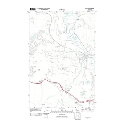
 1993 Fall City1993 Print · USGSKing County's river valleys and foothills are captured here in the early nineties as suburban development began to blend with rural landscapes. Genealogists and historians can locate the Fall City Cemetery and trace the paths of the Old RR Grade and Tiger Mountain Trail.
 - 2011 Map of Snoqualmie, 2011 Print
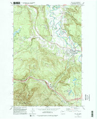
 2011 Snoqualmie2011 Print · USGSCovers Snoqualmie, including North Bend, Ellisville, and other nearby areas
 - 2011 Map of Fall City, 2011 Print
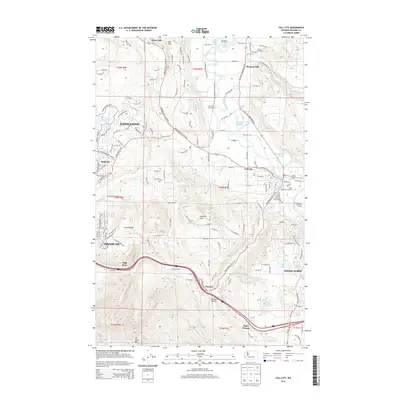
 2011 Fall City2011 Print · USGSCovers Snoqualmie, including Sammamish, Issaquah, and other nearby areas
 - 2014 Map of Fall City, 2014 Print
 2014 Fall City2014 Print · USGSCovers Snoqualmie, including Sammamish, Issaquah, and other nearby areas
 - 2014 Map of Snoqualmie, 2014 Print
 2014 Snoqualmie2014 Print · USGSCovers Snoqualmie, including North Bend, Ellisville, and other nearby areas
 - 2017 Map of Snoqualmie, 2017 Print
 2017 Snoqualmie2017 Print · USGSCovers Snoqualmie, including North Bend, Ellisville, and other nearby areas
 - 2017 Map of Fall City, 2017 Print
 2017 Fall City2017 Print · USGSCovers Snoqualmie, including Sammamish, Issaquah, and other nearby areas
 - 2020 Map of Snoqualmie, 2020 Print
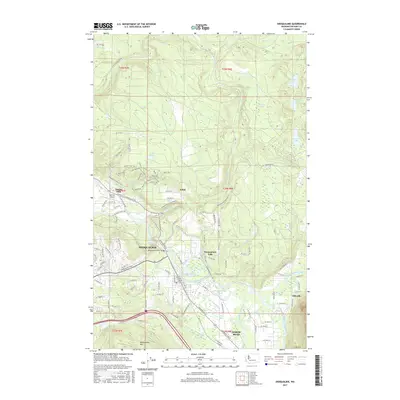
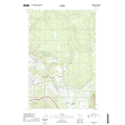 2020 Snoqualmie2020 Print · USGSCovers Snoqualmie, including North Bend, Ellisville, and other nearby areas
 - 2020 Map of Fall City, 2020 Print
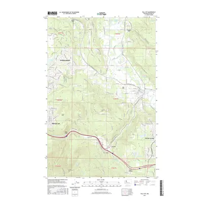
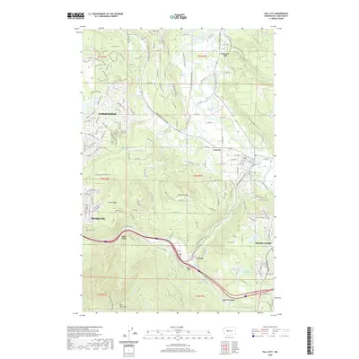 2020 Fall City2020 Print · USGSCovers Snoqualmie, including Sammamish, Issaquah, and other nearby areas
 - 2023 Map of Snoqualmie, 2023 Print
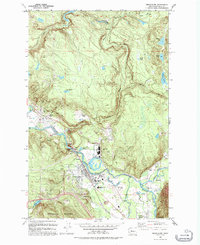
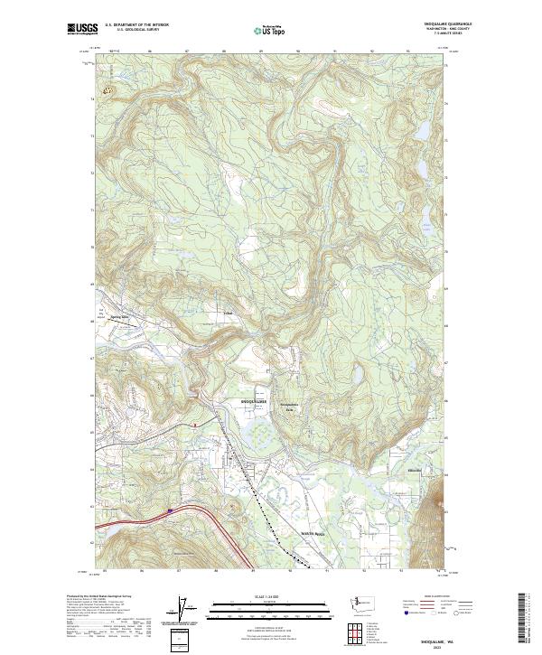 2023 Snoqualmie2023 Print · USGSThe confluence of the Snoqualmie forks is captured in this modern survey of the river valley. Genealogists and locals can trace the road networks and neighborhood developments around Snoqualmie, North Bend, and landmarks like Snoqualmie Falls.
 - 2023 Map of Fall City, 2023 Print
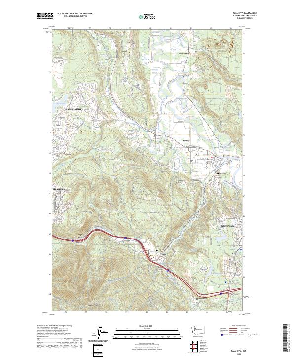 2023 Fall City2023 Print · USGSThe Snoqualmie River valley is captured here in the early twenty-first century, showing the interface between growing suburbs and timber-industry heritage. Trace local genealogy and history through the Fall City Cem, the waters of Preston Mill Pond, and landmarks like Teaters Bluff.
End of results
Showing maps 1-18 of 18
Top cities near Snoqualmie
- Kent historical maps
- Redmond historical maps
- Sammamish historical maps
- Issaquah historical maps
- Maple Valley historical maps
- Union Hill-Novelty Hill historical maps
See more
Top neighborhoods of Snoqualmie
- Eagle Nest historical maps
- Fairway historical maps
- Palisades historical maps
- Crestview historical maps
- Meadowbrook historical maps
- Eagle Lake historical maps
See more
Frequently asked questions
- What are the different types of historical maps available for Snoqualmie?
- What is the oldest map of Snoqualmie?
- Where can I purchase historical maps of Snoqualmie for my home or office?
- Where can I download high-res historical maps of Snoqualmie?
- Are there historical topographic maps available for Snoqualmie?
- Is there historical aerial imagery available for Snoqualmie?
- Where are historical maps of Snoqualmie sourced from?