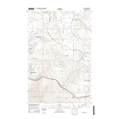
2014 Map of Fall City
USGS Topo · Published 2014About this map
The Snoqualmie River and its complex network of sloughs, including Rutherford Slough and Janicke Slough, define the low-lying valley floor between Sammamish and Fall City. This 2014 survey captures a landscape where river-driven geography meets modern infrastructure, with the Raging River descending from the south to meet the Snoqualmie near the center of the quadrangle. Significant elevation changes are marked by Mitchell Hill and the northern slopes of W Tiger Mtn, which rise sharply above the settlement of High Point. The map provides a detailed view of the corridor following the interstate through Preston, while smaller water bodies like Ames Lake and Lake Alice dot the higher plateaus. Local recreational and community landmarks such as Camp Don Bosco and the Tall Chief Golf Course are situated among the winding routes of the valley, reflecting the transition from agricultural river bottoms to residential development.
Find a feature on this map
115 named features on this map. Tap any name to fly to it.
Don’t see what you’re looking for? This feature index may not catch every label — zoom into the map to look around manually.
Map Details
Editions of this 2014 Fall City Map
This is the sole edition of this map. No revisions or reprints were ever made.
Other maps of this area

1895 · Snohomish
USGS Topo · 1:125,000

1897 · Tacoma
USGS Topo · 1:125,000

1897 · Seattle
USGS Topo · 1:125,000

1900 · Tacoma
USGS Topo · 1:125,000

1913 · Cedar Lake
USGS Topo · 1:125,000

1921 · Sultan
USGS Topo · 1:125,000

1923 · Sultan
USGS Topo · 1:125,000

1949 · Maple Valley
USGS Topo · 1:24,000

1950 · Redmond
USGS Topo · 1:24,000

1950 · Issaquah
USGS Topo · 1:24,000