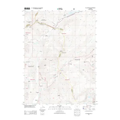
2013 Map of Fall River Pass
USGS Topo · Published 2013About this map
Continental Divide crests through this high-altitude landscape where the headwaters of the Colorado River and the Cache la Poudre River begin their descent. The terrain is marked by the engineering legacy of the Grand Ditch and Upper Michigan Ditch, massive water diversion projects that cut across steep slopes like Mount Neota and Thunder Mountain. These ditches, alongside features like Ditch Camp and the Milner Pass Road Camp, illustrate the historic effort to manage alpine water resources in the early twentieth century. Traces of human presence are visible at the Lulu City Cem, a remnant of the mining boom era near Skeleton Gulch, while the Phantom Valley Trading Post serves as a reminder of early tourism and commerce in the Kawuneeche Valley. From the high elevations of Specimen Mountain to the specialized road features like Tundra Curves on Us-34 E, the map documentation highlights the transition from resource extraction to managed parkland.
Find a feature on this map
90 named features on this map. Tap any name to fly to it.
Don’t see what you’re looking for? This feature index may not catch every label — zoom into the map to look around manually.
Map Details
Editions of this 2013 Fall River Pass Map
This is the sole edition of this map. No revisions or reprints were ever made.
Other maps of this area

1915 · Longs Peak
USGS Topo · 1:125,000

1916 · Home
USGS Topo · 1:125,000

1919 · Rocky Mountain National Park
USGS Topo · 1:125,000

1920 · Home
USGS Topo · 1:125,000

1954 · Greeley
USGS Topo · 1:250,000

1957 · Greeley
USGS Topo · 1:250,000

1957 · Mc Henrys Peak
USGS Topo · 1:24,000

1957 · Trail Ridge
USGS Topo · 1:24,000

1957 · Mount Richthofen
USGS Topo · 1:24,000

1957 · Bowen Mountain
USGS Topo · 1:24,000