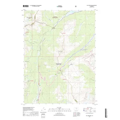
2019 Map of Fall River Pass
USGS Topo · Published 2019About this map
Rocky Mountain National Park and the surrounding wilderness of Roosevelt National Forest meet at the Continental Divide, where high-altitude passes like Milner Pass and Fall River Pass connect the rugged terrain of northern Colorado. The headwaters of the Colorado River flow through the Kawuneeche Valley, tracing a path near the historical mining site of the Lulu City Cem. This 2019 survey documents a landscape defined by its alpine hydrology and extensive trail network, including the Colorado River Trail and the Lulu City Network Trail. Water management is represented by the Grand Ditch Access, a feature that highlights the region's long history of trans-basin water diversion. Peaks such as Jackstraw Mtn and Specimen Mtn rise above glacial features like Lake Irene and the Big Thompson River, illustrating the complex drainage patterns of the Never Summer Mountains.
Find a feature on this map
73 named features on this map. Tap any name to fly to it.
Don’t see what you’re looking for? This feature index may not catch every label — zoom into the map to look around manually.
Map Details
Editions of this 2019 Fall River Pass Map
This is the sole edition of this map. No revisions or reprints were ever made.
Other maps of this area

1915 · Longs Peak
USGS Topo · 1:125,000

1916 · Home
USGS Topo · 1:125,000

1919 · Rocky Mountain National Park
USGS Topo · 1:125,000

1920 · Home
USGS Topo · 1:125,000

1954 · Greeley
USGS Topo · 1:250,000

1957 · Greeley
USGS Topo · 1:250,000

1957 · Mc Henrys Peak
USGS Topo · 1:24,000

1957 · Trail Ridge
USGS Topo · 1:24,000

1957 · Mount Richthofen
USGS Topo · 1:24,000

1957 · Bowen Mountain
USGS Topo · 1:24,000