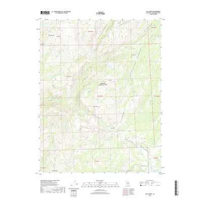
2018 Map of Falls Ridge
USGS Topo · Published 2018About this map
Yosemite National Park defines this high-elevation landscape, where the Tuolumne River carves a dramatic path through the backcountry of Tuolumne County. The river's descent is marked by a series of significant hydrological features, including Waterwheel Falls, Le Conte Falls, and the White Cascade near the camp at Glen Aulin. This 2018 survey detail shows how the river connects the broad expanse of Tuolumne Meadows to the deep glacial troughs of Matterhorn Canyon and Virginia Canyon. Hikers and researchers can trace the long-distance route of the Pacific Crest National Scenic Trail as it traverses the ridges and valleys between Regulation Peak and Pothole Dome. The mapping illustrates the complex drainage network of creeks like Return Cr and Cathedral Cr that feed the river system during the modern era.
Find a feature on this map
46 named features on this map. Tap any name to fly to it.
Don’t see what you’re looking for? This feature index may not catch every label — zoom into the map to look around manually.
Map Details
Editions of this 2018 Falls Ridge Map
This is the sole edition of this map. No revisions or reprints were ever made.
Other maps of this area

1896 · Dardanelles
USGS Topo · 1:125,000

1897 · Yosemite
USGS Topo · 1:125,000

1898 · Dardanelles
USGS Topo · 1:125,000

1900 · Yosemite
USGS Topo · 1:125,000

1901 · Mt. Lyell
USGS Topo · 1:125,000

1903 · Yosemite
USGS Topo · 1:125,000

1909 · Yosemite
USGS Topo · 1:125,000

1909 · Bridgeport
USGS Topo · 1:125,000

1911 · Bridgeport
USGS Topo · 1:125,000

1920 · Bridgeport
USGS Topo · 1:125,000