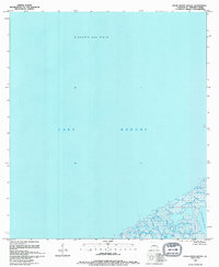
1994 Map of False Mouth Bayou
USGS Topo · Published 1994About this map
Rigolets Gas Field defines the northern reaches of this coastal quadrangle, where industrial energy extraction meets the tidal waters of Lake Borgne. The landscape is dominated by the intricate wetland systems of the Mississippi River delta, featuring the complex network of the Lakes of Bayou Marron and secluded waters like Magill Lagoon. This 1994 revision, based on surveys dating back to the 1950s, documents a fragile shoreline where narrow passages like Mosquito Inlet provide the only breaks in the marsh. The map illustrates a region almost entirely below five feet in elevation, highlighting the vulnerability and shifting nature of the St. Bernard Parish coastline during the late twentieth century.
Find a feature on this map
7 named features on this map. Tap any name to fly to it.
Don’t see what you’re looking for? This feature index may not catch every label — zoom into the map to look around manually.
Map Details
Editions of this 1994 False Mouth Bayou Map
This is the sole edition of this map. No revisions or reprints were ever made.
Other maps of this area

1893 · Rigolets
USGS Topo · 1:62,500

1893 · Shell Beach
USGS Topo · 1:62,500

1893 · Toulme
USGS Topo · 1:62,500

1895 · Bodreau
USGS Topo · 1:62,500

1935 · English Lookout
USGS Topo · 1:31,680

1935 · Grand Island Pass
USGS Topo · 1:31,680

1936 · Rigolets
USGS Topo · 1:62,500

1939 · Shell Beach
USGS Topo · 1:62,500

1941 · Shell Beach
USGS Topo · 1:62,500

1946 · Lake Eugenie
USGS Topo · 1:31,680