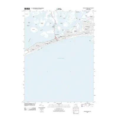
2012 Map of Far Rockaway
USGS Topo · Published 2012About this map
Rockaway Beach and the diverse shoreline of Jamaica Bay define this coastal landscape at the start of the 2010s. The dense urban grid of the Rockaway Peninsula is meticulously detailed, stretching from the residential streets of Neponsit and Belle Harbor in the west through Far Rockaway toward Inwood. Public housing developments like Hammel Houses and Edgemere Houses stand near the industrial and infrastructure corridors of the peninsula.
Find a feature on this map
73 named features on this map. Tap any name to fly to it.
Don’t see what you’re looking for? This feature index may not catch every label — zoom into the map to look around manually.
Map Details
Editions of this 2012 Far Rockaway Map
This is the sole edition of this map. No revisions or reprints were ever made.
Other maps of this area

1889 · Brooklyn
USGS Topo · 1:62,500

1891 · Brooklyn
USGS Topo · 1:62,500

1897 · Brooklyn
USGS Topo · 1:62,500

1897 · Hempstead
USGS Topo · 1:62,500

1898 · Hempstead
USGS Topo · 1:62,500

1898 · Brooklyn
USGS Topo · 1:62,500

1899 · Hempstead
USGS Topo · 1:62,500

1900 · Brooklyn
USGS Topo · 1:62,500

1903 · Hempstead
USGS Topo · 1:62,500
1947 · Brooklyn
USGS Topo · 1:24,000