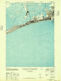
1947 Map of Far Rockaway
USGS Topo · Published 1947About this map
Jamaica Bay and its complex archipelago of marshes dominate the northern half of this post-war survey, where the Long Island Railroad cuts a straight line south toward the Atlantic. This era captures the Rockaway Peninsula at a peak of maritime and recreational development, featuring the iconic Boardwalk stretching from Seaside through Arverne to Edgemere. The map reveals the dense urban grid of Far Rockaway alongside the sprawling grounds of Jacob Riis Park and institutional landmarks like the Marine Hosp and Childrens Hosp. Further north, the isolated communities of Broad Channel and The Raunt appear amidst a labyrinth of wetlands like Duck Point Marsh and Jo Cos Marsh, illustrating the tenuous balance between mid-century infrastructure and the shifting tides of the New York coastline.
Find a feature on this map
57 named features on this map. Tap any name to fly to it.
Don’t see what you’re looking for? This feature index may not catch every label — zoom into the map to look around manually.
Map Details
Editions of this 1947 Far Rockaway Map
This is the sole edition of this map. No revisions or reprints were ever made.
Other maps of this area

1889 · Brooklyn
USGS Topo · 1:62,500

1891 · Brooklyn
USGS Topo · 1:62,500

1897 · Brooklyn
USGS Topo · 1:62,500

1897 · Hempstead
USGS Topo · 1:62,500

1898 · Hempstead
USGS Topo · 1:62,500

1898 · Brooklyn
USGS Topo · 1:62,500

1899 · Hempstead
USGS Topo · 1:62,500

1900 · Brooklyn
USGS Topo · 1:62,500

1903 · Hempstead
USGS Topo · 1:62,500
1947 · Brooklyn
USGS Topo · 1:24,000