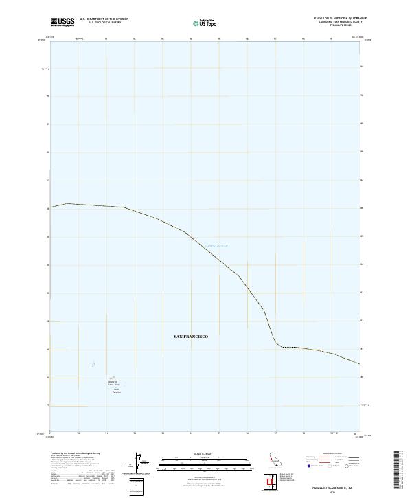
2021 Map of Farallon Islands OE N
USGS Topo · Published 2021About this map
The North Farallon islands rise from the Pacific Ocean in this 2021 study of the outermost reaches of San Francisco city limits. This remote maritime territory, located nearly thirty miles west of the Golden Gate, is dominated by the rocky outcrops of the Island of Saint James. The map illustrates the minimal land area of these volcanic stacks, which serve as critical habitat within a larger marine sanctuary. The boundary for San Francisco is clearly marked, indicating the extent of the city's jurisdiction far into the open sea. This edition provides a modern topographic record of these isolated landmarks, focusing on the bathymetry and the stark isolation of the Farallones as they appeared in the early 2020s.
Find a feature on this map
4 named features on this map. Tap any name to fly to it.
Don’t see what you’re looking for? This feature index may not catch every label — zoom into the map to look around manually.
Map Details
Editions of this 2021 Farallon Islands OE N Map
This is the sole edition of this map. No revisions or reprints were ever made.
Other maps of this area

1947 · San Francisco
USGS Topo · 1:250,000

1948 · San Francisco
USGS Topo · 1:250,000

1955 · San Francisco
USGS Topo · 1:250,000

1956 · San Francisco
USGS Topo · 1:250,000
1957 · San Francisco
USGS Topo · 1:250,000
1960 · San Francisco
USGS Topo · 1:250,000
1961 · San Francisco
USGS Topo · 1:250,000
1964 · San Francisco
USGS Topo · 1:250,000
1971 · San Francisco
USGS Topo · 1:250,000
1978 · San Francisco
USGS Topo · 1:100,000